
Category:1830s maps of Toronto
Most populous urban areas of the world: Boston [US] · Chicago [US] · Istanbul [TR] · London [GB] · New York City [US] · Paris [FR] · Philadelphia [US] · Toronto [CA] · Washington, D.C. [US]
Media in category "1830s maps of Toronto"
The following 8 files are in this category, out of 8 total.
-
 Town of York, Surveyor General's Office, York, 14th July 1830 - YP10-14-SR6469.jpg 8,114 × 2,385; 5.43 MB
-
 Boundaries of newly incorporated Toronto -- 1834.jpg 391 × 200; 92 KB
-
 City of Toronto and Liberties, 1834.jpg 1,920 × 1,060; 170 KB
-
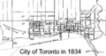 City of Toronto in 1834.gif 500 × 261; 13 KB
-
 Map of Toronto in 1834.jpg 1,399 × 1,920; 298 KB
-
 Toronto 1834 map.png 1,915 × 944; 3.07 MB
-
 Toronto in 1834 (29987060380).jpg 1,399 × 1,920; 685 KB
-
 TorontoNewTownExtensionPlan1837.jpg 700 × 500; 98 KB


.jpg)
