
Category:1830s maps of London
Media in category "1830s maps of London"
The following 31 files are in this category, out of 31 total.
-
 1830 HackneyVillage.png 2,156 × 2,706; 514 KB
-
 1830londonSW.png 6,189 × 6,189; 83.65 MB
-
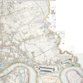 1830londonNE.png 7,500 × 7,500; 97.78 MB
-
 1830londonNN.png 6,222 × 6,222; 82.29 MB
-
 1830londonNW.png 6,175 × 7,000; 86.21 MB
-
 1830londonSE.png 7,500 × 7,500; 97.55 MB
-
 1830londonSS.png 6,222 × 6,222; 80.06 MB
-
 1830londonSW - Battersea Pk.jpg 2,625 × 1,157; 907 KB
-

-
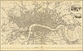
 SDUK MAP Environment of London 1832.jpg 4,680 × 4,000; 7.51 MB
-

-

-

-
 Map of the southern end of the River Lee Navigation.png 1,214 × 1,115; 2.68 MB
-

-

-
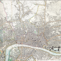
 1836 map of London.jpg 15,500 × 9,714; 37.97 MB
-
 Europa - no-nb krt 01010.jpg 7,973 × 10,790; 25.38 MB
-

-
 275 of 'London, edited by C. K' (11005425523).jpg 1,036 × 955; 255 KB
-
 Chadwick's Bethnal Green Parish map. Wellcome L0009782.jpg 3,572 × 2,892; 4.15 MB
-
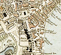 Charing Cross London from 1833 Schmollinger map.jpg 726 × 657; 363 KB
-
 Hundreds of Middlesex.svg 735 × 756; 70 KB
-

-
 Kings Bench RULES of the KING'S BENCH PRISON 1830.jpg 712 × 564; 248 KB
-
 London; plan of the Hospitals & Medical Schools, 1836-1837. Wellcome L0003200.jpg 1,589 × 1,236; 824 KB
-
 Map of St Paul's, 1830.png 479 × 412; 518 KB
-
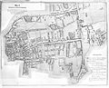
 North Southwark 1830.png 1,711 × 1,368; 5.6 MB
-
 Port Of London 1837.jpg 1,752 × 1,168; 536 KB
-
 Regent's Park London from 1833 Schmollinger map.jpg 1,602 × 1,628; 801 KB
-
 Topographischer Stadtplan London 1832 (ca. 1-7.500).jpg 21,839 × 14,938; 114.15 MB


%27_(11003309034).jpg)
%27_(11003425163).jpg)
%27_(11222125046).jpg)

.jpg)
.jpg)


.jpg)


.jpg)