
Category:1790s maps of Toronto
Most populous urban areas of the world: Boston [US] · London [GB] · New York City [US] · Paris [FR] · Philadelphia [US] · Toronto [CA] · Washington, D.C. [US]
Media in category "1790s maps of Toronto"
The following 10 files are in this category, out of 10 total.
-
 Plan of Toronto Harbour, Joseph Bouchette, 1792.png 1,267 × 955; 1.99 MB
-
 Plan of York Harbour, 1792, 1815.gif 400 × 247; 12 KB
-
 1793 map of what is now Toronto harbour.jpg 668 × 441; 22 KB
-
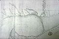
 Map of Old York (Toronto) habrbour -- 1793.jpg 409 × 392; 42 KB
-
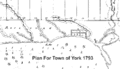 Plan for Town of York 1793.gif 500 × 287; 14 KB
-
 Plan of York harbour surveyed by order of Lieut. Govr. Simcoe by A. Aitken.jpg 1,920 × 1,403; 818 KB
-
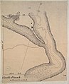 Castle Frank, 1794.jpg 1,560 × 1,920; 1.1 MB
-

-
 Plan submitted by Order of His Honor the President for the enlargement of York.jpg 1,920 × 1,011; 589 KB
-
 His Honor the Presdt approval of the Town Plot of York. 2nd addition.jpg 1,920 × 1,089; 806 KB


_habrbour_--_1793.jpg)


