
Category:1810s maps of Toronto
Most populous urban areas of the world: Boston [US] · Istanbul [TR] · London [GB] · Moscow [RU] · New York City [US] · Paris [FR] · Philadelphia [US] · Toronto [CA] · Washington, D.C. [US]
Media in category "1810s maps of Toronto"
The following 10 files are in this category, out of 10 total.
-
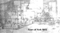 Town of York 1813.gif 500 × 273; 32 KB
-

-
 Plan of the town and harbour of York, Upper Canada, 1814.jpg 7,200 × 5,424; 3.51 MB
-
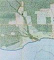
 Plan of York Harbour (29652973174).jpg 1,920 × 1,208; 1.16 MB
-

-
 1818 map of York, Upper Canada.jpg 406 × 351; 50 KB
-
 Lower course of Garrison Creek, 1818.jpg 185 × 204; 34 KB
-
 Plan of the Town of York (1816).jpg 1,920 × 884; 331 KB
-
 Russell Creek, circa 1818.jpg 94 × 136; 12 KB
-
 Streetplan of the city of York, Upper Canada, circa 1818.jpg 744 × 493; 96 KB


.jpg)
.jpg)


.jpg)

