Category:1810s maps of London
Appearance
Subcategories
This category has only the following subcategory.
Media in category "1810s maps of London"
The following 25 files are in this category, out of 25 total.
-
The Island, Limehouse Cut.png 2,219 × 1,566; 8.62 MB
-
Image taken from page 31 of 'Old and New London, etc' (11186270915).jpg 1,892 × 1,696; 931 KB
-
Image taken from page 228 of 'Old and New London, etc' (11188489485).jpg 1,892 × 1,652; 671 KB
-
Smith's New Map of London (1816).jpg 1,106 × 787; 222 KB
-
Horwood Faden 1819.jpg 2,674 × 1,697; 1.14 MB
-
Horwood's 1819 map showing the Limehouse Cut, London.png 1,839 × 1,266; 5.17 MB
-
Limehouse basins 1819.jpg 2,601 × 1,753; 1.04 MB
-
The Bromley end of the Limehouse Cut c.1800.png 1,956 × 1,526; 6.13 MB
-
Blackfriars Road Street Map 1817.jpg 372 × 304; 64 KB
-
Burlington House Horwood 1819 ed edited.jpg 587 × 318; 72 KB
-
Drawing, map (BM Ee,4.88).jpg 2,085 × 1,515; 297 KB
-
Extract from Greenwood Map of Middlesex 1819.png 632 × 208; 144 KB
-
Fawkes Hall, Lambeth (detail).jpg 1,000 × 350; 110 KB
-
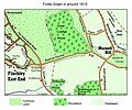
Fortis Green 1815.jpg 1,361 × 1,133; 569 KB
-
Hanover Square Horwood 1819.jpg 359 × 512; 68 KB
-
London 1815 map.jpg 8,534 × 5,571; 14.72 MB
-
Regent St Horwood 1819 ed edited.jpg 738 × 1,120; 252 KB
-
Regent St proposal published 1813.jpg 712 × 396; 77 KB
-
Royal College of Physicians, Warwick Lane, London, with a ma Wellcome V0013094.jpg 2,066 × 3,409; 2.84 MB
-
Savile Street by Horwood 1819.jpg 1,920 × 2,453; 1.92 MB
-
Survey of the Roads and Foot paths in the Parish of Islington.jpg 3,666 × 5,702; 3.28 MB


