Category:Topographic maps of Shiga prefecture
Jump to navigation
Jump to search
English: Category for the topographic maps of Shiga Prefecture, Japan
日本語: 日本・滋賀県に関する地形図のカテゴリ
| Prefectures of Japan 地形図 (Topographic map) | |||
|---|---|---|---|
|

| ||
Media in category "Topographic maps of Shiga prefecture"
The following 4 files are in this category, out of 4 total.
-
 Mount Hiei Relief Map, SRTM-1.jpg 800 × 600; 272 KB
-
 Mount Ibuki Relief Map, SRTM-1.jpg 800 × 600; 302 KB
-
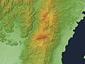
 Suzuka Mountains Relief Map, SRTM-1.jpg 1,200 × 2,400; 2.01 MB
-
 Suzuka Pass Relief Map, SRTM-1 (marked).jpg 800 × 600; 457 KB


.jpg)