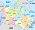
Category:Spanish-language SVG maps of Canada
Jump to navigation
Jump to search
Subcategories
This category has only the following subcategory.
Media in category "Spanish-language SVG maps of Canada"
The following 6 files are in this category, out of 6 total.
-
Canada, administrative divisions - es - colored.svg 1,084 × 920; 928 KB
-
Cascade Range subdivisions map-es.svg 403 × 693; 2.99 MB
-
Columbia drainage basin major dams map-es.svg 808 × 790; 2.9 MB
-
Greater Toronto Area map-es.svg 643 × 500; 263 KB
-
Grlakes lawrence map-es.svg 592 × 477; 256 KB
-
Webster-Ashburton treaty map-es.svg 730 × 583; 112 KB


