Category:Spanish-language SVG maps of Costa Rica
Jump to navigation
Jump to search
Media in category "Spanish-language SVG maps of Costa Rica"
The following 11 files are in this category, out of 11 total.
-
Alajuela map1.svg 691 × 819; 100 KB
-
Areas Conservacion CR.svg 1,580 × 1,492; 186 KB
-
Mapa del Caribe (límites marinos).svg 5,340 × 3,660; 3.02 MB
-
Mapa del Mar Caribe (límites marinos).svg 3,587 × 2,221; 1.98 MB
-
Costa Rica - Huetar Norte (castellano).svg 313 × 218; 5 KB
-
Mapa CR CVC.svg 1,522 × 828; 181 KB
-
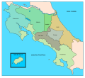
Mapa CR Provincias.svg 764 × 696; 118 KB
-
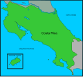
Mapa CR.svg 722 × 664; 77 KB
-
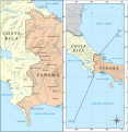
Mapa de la frontera Costa Rica-Panamá.svg 911 × 938; 412 KB
-
Mapa del Mar de Balboa (límites marinos).svg 2,177 × 2,006; 530 KB
-
Nicaragua canal proposals - es.svg 2,149 × 1,684; 817 KB


