Category:SVG maps of regions of France
Jump to navigation
Jump to search
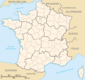
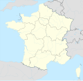
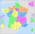
Administrative regions and territorial collectivity of Metropolitan France (‡ since start of 2016):
Auvergne-Rhône-Alpes‡ · Bourgogne-Franche-Comté‡ · Brittany · Centre-Val de Loire · Corsica · Grand Est‡ · Hauts-de-France‡ · Île-de-France · Normandy‡ · Nouvelle-Aquitaine‡ · Occitania‡ · Pays de la Loire · Provence-Alpes-Côte d'Azur
Former administrative regions of Metropolitan France (until end of 2015):
Alsace · Aquitaine · Auvergne · Burgundy · Champagne-Ardenne · Franche-Comté · Languedoc-Roussillon · Limousin · Lorraine · Midi-Pyrénées · Nord-Pas-de-Calais · Lower Normandy · Upper Normandy · Picardy · Poitou-Charentes · Rhône-Alpes
Overseas departments and regions: Guadeloupe · Martinique · French Guiana · Réunion · Mayotte
Overseas collectivities: Saint Barthélemy · Saint-Martin · Saint Pierre and Miquelon · French Polynesia · Wallis and Futuna · French Southern and Antarctic Lands+
Sui generis territories: New Caledonia · Clipperton Island+
Subcategories
This category has the following 3 subcategories, out of 3 total.
*
.
Media in category "SVG maps of regions of France"
The following 56 files are in this category, out of 56 total.
-
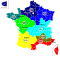
ALPC (França 2016).svg 265 × 340; 373 KB
-
Alps-Mediterranean Euroregion map-ar.svg 1,465 × 1,126; 483 KB
-
Alps-Mediterranean Euroregion map-de.svg 1,465 × 1,126; 228 KB
-
Alps-Mediterranean Euroregion map-el.svg 1,465 × 1,126; 344 KB
-
Alps-Mediterranean Euroregion map-en.svg 1,465 × 1,126; 344 KB
-
Alps-Mediterranean Euroregion map-eo.svg 1,465 × 1,126; 344 KB
-
Alps-Mediterranean Euroregion map-fr.svg 1,465 × 1,126; 344 KB
-
Alps-Mediterranean Euroregion map-it.svg 1,465 × 1,126; 344 KB
-
Carte climatique de la France.svg 1,797 × 1,796; 311 KB
-
Carte France Régions.svg 588 × 550; 1.72 MB
-
Carte indicatifs téléphoniques français.svg 492 × 542; 176 KB
-
Carte-ORTF de.svg 875 × 686; 211 KB
-
Carte-ORTF.svg 846 × 656; 203 KB
-
Cridon.svg 530 × 550; 494 KB
-
Departements de France map.svg 588 × 550; 273 KB
-
Départements et régions de France 2016.svg 588 × 550; 226 KB
-
FIR France.svg 801 × 801; 1.07 MB
-
Fond de carte des 13 nouvelles régions de France métropolitaine.svg 495 × 544; 43 KB
-
FR-Régions.svg 463 × 436; 354 KB
-
France adm location map.svg 2,000 × 1,922; 524 KB
-
France all regions.svg 386 × 296; 152 KB
-
France drainage basins mk.svg 2,000 × 1,898; 802 KB
-
France drainage basins-es.svg 2,133 × 2,025; 893 KB
-
France drainage basins.svg 2,000 × 1,898; 728 KB
-
France location map – regions and departments (including overseas).svg 2,000 × 1,922; 1,005 KB
-
France location map-Regions and departments with Paris and inner ring in a box-2016.svg 2,000 × 1,922; 598 KB
-
France map Lambert-93 with regions-blank.svg 2,000 × 1,898; 713 KB
-
France regions MH-de.svg 900 × 900; 91 KB
-
France regions MH-fr.svg 900 × 900; 91 KB
-
France régionale arpitan Règ·ions de la France.svg 2,000 × 1,898; 4.55 MB
-
France régionale brezhoneg Rannvroioù eus Frañs.svg 2,000 × 1,898; 4.35 MB
-
France régionale català Regió francesa.svg 2,000 × 1,898; 4.55 MB
-
France régionale elsassirditch Regione vo Frankriich.svg 2,000 × 1,898; 4.55 MB
-
France régionale euskara Frantziako eskualdeak.svg 2,000 × 1,898; 4.55 MB
-
France régionale.svg 2,000 × 1,898; 4.55 MB
-
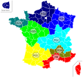
France telephone area codes.svg 210 × 220; 267 KB
-
Francia en Wikiviajes.svg 2,000 × 1,898; 2.51 MB
-
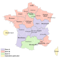
French school zones-fr.svg 2,000 × 1,922; 676 KB
-
Langues de la France eo.svg 2,000 × 1,898; 1.2 MB
-
Langues de la France ru.svg 2,000 × 1,898; 1.36 MB
-
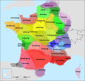
Langues de la France.svg 2,000 × 1,898; 1.18 MB
-
Occitanie.svg 313 × 301; 328 KB
-
Provinces ecclésiastiques (France) II.svg 507 × 553; 160 KB
-
Provinces ecclésiastiques (France).svg 588 × 550; 87 KB
-
Provinces ecclésiastiques 2002 (France).svg 507 × 553; 165 KB
-
Rannvroioù Frañs 2016.svg 575 × 575; 74 KB
-
Regiones metropolitanas de Francia.svg 606 × 555; 353 KB
-
Regions de France.svg 625 × 625; 200 KB
-
Regions France 2016.svg 575 × 575; 76 KB
-
RT 2005 zone climatique-2.svg 588 × 550; 193 KB
-
RT 2005 zone climatique.svg 588 × 550; 183 KB
-
Régions de France avant 2016.svg 588 × 550; 363 KB
-
Régions de France-de.svg 588 × 550; 332 KB
-
Yezhoù Frañs.svg 2,000 × 1,898; 1.17 MB
-
Zones vacances France 2016.svg 2,000 × 1,922; 979 KB
-
Регионы Франции 2016.svg 1,000 × 960; 237 KB


