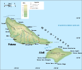
Category:SVG maps of Wallis and Futuna
Jump to navigation
Jump to search
Administrative regions and territorial collectivity of Metropolitan France (‡ since start of 2016):
Auvergne-Rhône-Alpes‡ · Bourgogne-Franche-Comté‡ · Brittany · Centre-Val de Loire · Corsica · Grand Est‡ · Hauts-de-France‡ · Île-de-France · Normandy‡ · Nouvelle-Aquitaine‡ · Occitania‡ · Pays de la Loire · Provence-Alpes-Côte d'Azur
Former administrative regions of Metropolitan France (until end of 2015):
Alsace · Aquitaine · Auvergne · Burgundy · Champagne-Ardenne · Franche-Comté · Languedoc-Roussillon · Limousin · Lorraine · Midi-Pyrénées · Nord-Pas-de-Calais · Lower Normandy · Upper Normandy · Picardy · Poitou-Charentes · Rhône-Alpes
Overseas departments and regions: Guadeloupe · Martinique · French Guiana · Réunion · Mayotte
Overseas collectivities: Saint Barthélemy · Saint-Martin · Saint Pierre and Miquelon · French Polynesia · Wallis and Futuna · French Southern and Antarctic Lands+
Sui generis territories: New Caledonia · Clipperton Island+
Departments of Metropolitan France: Ain [01] · Ardennes [08] · Aube [10] · Aude [11] · Cher [18] · Dordogne [24] · Finistère [29] · Jura [39] · Manche [50] · Bas-Rhin [67] · Haut-Rhin [68] · departmental district of the Rhône [69] · Rhône [69D]‡ · Metropolis of Lyon [69M]‡ · Paris [75] · Somme [80] · Tarn [81] · Tarn-et-Garonne [82] · Vaucluse [84] · Haute-Vienne [87] · Territoire de Belfort [90]
Overseas departments and regions: Guadeloupe [971] · Martinique [972] · French Guiana [973] · Réunion [974] · Mayotte [976]
Overseas collectivities: Saint Pierre and Miquelon [975] · Saint Barthélemy [977] · Saint-Martin [978] · Wallis and Futuna [986] · French Polynesia [987] · French Southern and Antarctic Lands [984]+
Sui generis territories: New Caledonia [988] · Clipperton Island [989]+
Subcategories
This category has only the following subcategory.
Media in category "SVG maps of Wallis and Futuna"
The following 32 files are in this category, out of 32 total.
-
Chemin d'entrée dans le lagon de Wallis par la passe Honikulu.svg 2,659 × 3,383; 1.68 MB
-
Députés sortants de Wallis-et-Futuna en 2017.svg 761 × 675; 2 KB
-
Futuna location map.svg 969 × 667; 50 KB
-
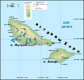
Horn topo map BE.svg 1,000 × 960; 137 KB
-
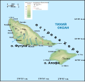
Horn topo map RU.svg 1,000 × 960; 140 KB
-
Kulo Lasi locator map (Wallis, Futuna, Niuafo'ou).svg 2,077 × 1,987; 114 KB
-
Lac Lalolalo et vao tapu à Wallis.svg 495 × 312; 414 KB
-
Lagon sud de Wallis - district de Mu'a.svg 2,659 × 3,383; 1.68 MB
-
Wallis (topographic-fr).svg 1,082 × 1,222; 357 KB
-
Wallis - map of the toafa.svg 1,082 × 1,222; 174 KB
-
Wallis and Futuna map RU.svg 2,000 × 1,316; 365 KB
-
Wallis Hahake district fr.svg 973 × 1,099; 549 KB
-
Wallis Hahake district wls.svg 973 × 1,099; 549 KB
-
Wallis Hihifo district fr.svg 973 × 1,099; 549 KB
-
Wallis Hihifo district wls.svg 973 × 1,099; 549 KB
-
Wallis Island topographic map (fr).svg 868 × 1,281; 151 KB
-
Wallis islands map DE.svg 1,082 × 1,222; 356 KB
-
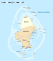
Wallis islands map MK.svg 868 × 1,281; 154 KB
-
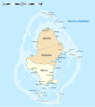
Wallis islands map RU.svg 868 × 1,281; 155 KB
-
Wallis location map.svg 1,082 × 1,222; 146 KB
-
Wallis Mu'a district fr.svg 973 × 1,099; 549 KB
-
Wallis Mu'a district wls.svg 973 × 1,099; 549 KB
-
Wallis-et-Futuna collectivity location map.svg 1,691 × 1,074; 89 KB
-
Wallis-et-Futuna législatives 1962.svg 1,178 × 1,293; 52 KB
-
Wallis-et-Futuna législatives 1978.svg 1,178 × 1,293; 52 KB
-
Wallis-et-Futuna législatives 1981.svg 1,178 × 1,293; 52 KB
-
Wallisandfutuna w1 locator.svg 1,000 × 1,000; 78 KB
-
Wallisandfutuna w2 locator.svg 1,000 × 1,000; 182 KB
-
Îles Horn (Wallis-et-Futuna)-de.svg 993 × 848; 81 KB
-
Îles Horn (Wallis-et-Futuna)-fr.svg 1,020 × 957; 160 KB
-
Îles Horn (Wallis-et-Futuna)-mk.svg 1,020 × 957; 160 KB
-
Астравы Уоліс.png 1,082 × 1,222; 114 KB


