Category:SVG maps of Bretagne
Jump to navigation
Jump to search
Administrative regions and territorial collectivity of Metropolitan France (‡ since start of 2016):
Auvergne-Rhône-Alpes‡ · Bourgogne-Franche-Comté‡ · Brittany · Centre-Val de Loire · Corsica · Grand Est‡ · Hauts-de-France‡ · Île-de-France · Normandy‡ · Nouvelle-Aquitaine‡ · Occitania‡ · Pays de la Loire · Provence-Alpes-Côte d'Azur
Former administrative regions of Metropolitan France (until end of 2015):
Alsace · Aquitaine · Auvergne · Burgundy · Champagne-Ardenne · Franche-Comté · Languedoc-Roussillon · Limousin · Lorraine · Midi-Pyrénées · Nord-Pas-de-Calais · Lower Normandy · Upper Normandy · Picardy · Poitou-Charentes · Rhône-Alpes
Overseas departments and regions: Guadeloupe · Martinique · French Guiana · Réunion · Mayotte
Overseas collectivities: Saint Barthélemy · Saint-Martin · Saint Pierre and Miquelon · French Polynesia · Wallis and Futuna · French Southern and Antarctic Lands+
Sui generis territories: New Caledonia · Clipperton Island+
Subcategories
This category has only the following subcategory.
Media in category "SVG maps of Bretagne"
The following 73 files are in this category, out of 73 total.
-
74739-Bretoieraren aldeko 2018ko Redadeg korrikaldia Bretainian.svg 426 × 324; 358 KB
-
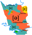
Accent tonique en breton map-fr.svg 650 × 650; 1.9 MB
-
Astour gallo.svg 410 × 456; 58 KB
-
Batholite mancellien.svg 1,770 × 1,340; 1.03 MB
-
Blank Map France Bretagne communes.svg 980 × 750; 615 KB
-
Breizh anvioù-lec'h.svg 600 × 600; 2.24 MB
-
Breizh douar ha dour.svg 2,484 × 1,900; 1.09 MB
-
Breizh douar ha mor.svg 2,484 × 1,900; 1.08 MB
-
Bretagne 5 departements location map.svg 532 × 393; 252 KB
-
Bretagne.svg 650 × 500; 364 KB
-
Breton - les taux de locuteurs selon le pays - sondage 2018.svg 922 × 712; 232 KB
-
Breton dialectes mk.svg 437 × 317; 184 KB
-
Breton dialectes-br.svg 437 × 317; 139 KB
-
Breton dialectes.svg 437 × 317; 140 KB
-
Brezhoneg-Feur komzerien dre vro sontadeg 2018 br.svg 922 × 712; 235 KB
-
Broioù kozh breizh.svg 946 × 724; 734 KB
-
Carte des terroirs de bagadoù en Bretagne.svg 1,064 × 786; 163 KB
-
Carte des terroirs de bagadoù lors du concours 2008.svg 1,064 × 786; 168 KB
-
Carte des terroirs de bagadoù lors du concours 2009.svg 1,064 × 786; 172 KB
-
Carte des terroirs de bagadoù lors du concours 2010.svg 1,064 × 786; 175 KB
-
Carte des terroirs de bagadoù lors du concours 2011.svg 1,064 × 786; 169 KB
-
Carte des terroirs de bagadoù lors du concours 2012.svg 1,064 × 786; 167 KB
-
Carte des terroirs de bagadoù lors du concours 2013.svg 1,064 × 786; 168 KB
-
Carte des terroirs de bagadoù lors du concours 2014.svg 1,064 × 786; 165 KB
-
Carte des terroirs de bagadoù lors du concours 2015.svg 1,064 × 786; 167 KB
-
Carte des terroirs de bagadoù lors du concours 2017.svg 1,064 × 786; 172 KB
-
Carte des terroirs de bagadoù lors du concours 2018.svg 1,064 × 786; 172 KB
-
Carte des terroirs de bagadoù lors du concours 2019.svg 1,064 × 786; 172 KB
-
Carte des terroirs de bagadoù lors du concours 2020.svg 1,064 × 786; 172 KB
-
Carte des terroirs de bagadoù lors du concours 2021.svg 1,064 × 786; 172 KB
-
Carte des terroirs de bagadoù lors du concours 2022.svg 1,064 × 786; 172 KB
-
Carte des terroirs de bagadoù lors du concours 2023.svg 1,064 × 786; 172 KB
-
Carte des terroirs de bagadoù lors du concours 2024.svg 1,064 × 786; 172 KB
-
Celtic countries.svg 547 × 979; 242 KB
-
Chwe Chenedl Geltaidd syml gyda Baneri.svg 360 × 711; 210 KB
-
Destinations touristiques de Bretagne.svg 1,949 × 1,378; 1.48 MB
-
Diorren an hañvlec'hioù e Breizh.svg 1,052 × 744; 1.49 MB
-
Dregantad anvioù-lec'h brezhonek.svg 1,064 × 794; 3.04 MB
-
Développement des stations balnéaires de Bretagne map-fr.svg 1,052 × 744; 1.49 MB
-
Emploi touristique en Bretagne map-fr.svg 1,031 × 770; 4.61 MB
-
France - Grand Ouest - map-blank.svg 736 × 624; 452 KB
-
France Pays bretons map.svg 946 × 724; 1,017 KB
-
Frontière linguistique du breton map-fr.svg 1,064 × 794; 4.45 MB
-
Geologic map Armorican Massif BR.svg 1,770 × 1,340; 985 KB
-
Geologic map Bay of Mont Saint-Michel FR.svg 1,770 × 1,340; 992 KB
-
Kartenn bevenn ar brezhoneg.svg 1,064 × 794; 4.06 MB
-
Localisation Duché de Bretagne.svg 650 × 500; 376 KB
-
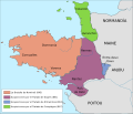
Map Kingdom of Brittany 845-867-br.svg 700 × 600; 40 KB
-
Map Kingdom of Brittany 845-867-de.svg 736 × 624; 250 KB
-
Map Kingdom of Brittany 845-867-es.svg 700 × 600; 179 KB
-
Map Kingdom of Brittany 845-867-fr.svg 700 × 600; 39 KB
-
Map Kingdom of Brittany 845-867-hu.svg 700 × 600; 41 KB
-
Map Kingdom of Brittany 845-867-pt.svg 700 × 600; 41 KB
-
Map Kingdom of Brittany 845-867-ru.svg 700 × 600; 57 KB
-
Map of Celtic Nations (alternate).svg 675 × 1,300; 90 KB
-
Map of Celtic Nations-flag shades.svg 675 × 1,300; 173 KB
-
Map of Celtic Nations.svg 675 × 1,300; 97 KB
-
Moi gallo.svg 407 × 538; 62 KB
-
Parti breton aux elections de 2024.svg 540 × 380; 125 KB
-
Participes gallo.svg 410 × 456; 59 KB
-
Participes2.svg 410 × 456; 73 KB
-
Pays Gallo.svg 1,029 × 725; 519 KB
-
Pluriel gallo.svg 407 × 538; 121 KB
-
Rail transport infrastructure map - FR - Bretagne.svg 983 × 511; 3.24 MB
-
Sites touristiques de la région Bretagne map-fr.svg 2,062 × 1,441; 2.14 MB
-
Strollad breizh e dilennadeg kannaded 2024.svg 540 × 380; 137 KB
-
Topographic map of Haute-Bretagne.svg 1,501 × 1,707; 767 KB
-
Toponymes bretons map-fr.svg 1,064 × 794; 3.01 MB
-
Val sans retour map-fr.svg 1,049 × 886; 241 KB
-
Variantes linguistiques du breton map-fr.svg 1,064 × 994; 1.67 MB
-
Vilaine River Drainage Basin map-br.svg 1,954 × 1,573; 805 KB
-
Vilaine River Drainage Basin map-fr.svg 1,954 × 1,573; 799 KB
-
Zone de production du cidre breton (2014).svg 592 × 296; 4.98 MB


