Category:SVG maps of Rhône-Alpes
Jump to navigation
Jump to search
Administrative regions and territorial collectivity of Metropolitan France (‡ since start of 2016):
Auvergne-Rhône-Alpes‡ · Bourgogne-Franche-Comté‡ · Brittany · Centre-Val de Loire · Corsica · Grand Est‡ · Hauts-de-France‡ · Île-de-France · Normandy‡ · Nouvelle-Aquitaine‡ · Occitania‡ · Pays de la Loire · Provence-Alpes-Côte d'Azur
Former administrative regions of Metropolitan France (until end of 2015):
Alsace · Aquitaine · Auvergne · Burgundy · Champagne-Ardenne · Franche-Comté · Languedoc-Roussillon · Limousin · Lorraine · Midi-Pyrénées · Nord-Pas-de-Calais · Lower Normandy · Upper Normandy · Picardy · Poitou-Charentes · Rhône-Alpes
Overseas departments and regions: Guadeloupe · Martinique · French Guiana · Réunion · Mayotte
Overseas collectivities: Saint Barthélemy · Saint-Martin · Saint Pierre and Miquelon · French Polynesia · Wallis and Futuna · French Southern and Antarctic Lands+
Sui generis territories: New Caledonia · Clipperton Island+
Subcategories
This category has the following 3 subcategories, out of 3 total.
~
Media in category "SVG maps of Rhône-Alpes"
The following 39 files are in this category, out of 39 total.
-
Carte Département Loire 02.svg 737 × 935; 189 KB
-
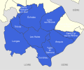
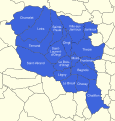
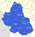
Communauté de communes Beaujolais Nizerand Morgon 2011.svg 512 × 316; 117 KB
-
Communauté de communes Beaujolais Val d'Azergues 2011.svg 512 × 835; 41 KB
-
Communauté de communes Beaujolais-Saône-Pierres-Dorées 2011.svg 512 × 664; 124 KB
-
Communauté de communes Beaujolais-Val-de-Saône 2011.svg 512 × 435; 106 KB
-
Communauté de communes Beaujolais-Vauxonne 2011.svg 512 × 247; 98 KB
-
Communauté de communes Chamousset en Lyonnais 2011.svg 512 × 487; 165 KB
-
Communauté de communes de l'Est Lyonnais 2011.svg 512 × 601; 51 KB
-
Communauté de communes de la Haute Vallée d'Azergues 2011.svg 512 × 900; 156 KB
-
Communauté de communes de la Région de Beaujeu.svg 512 × 538; 193 KB
-
Communauté de communes de la Région de Condrieu 2011.svg 512 × 426; 76 KB
-
Communauté de communes de la Vallée du Garon 2011.svg 512 × 903; 116 KB
-
Communauté de communes des Hauts du Lyonnais 2011.svg 512 × 414; 129 KB
-
Communauté de communes des Monts d'Or Azergues 2011.svg 512 × 629; 93 KB
-
Communauté de communes des Pays du Bois d'Oingt 2011.svg 512 × 536; 231 KB
-
Communauté de communes des Vallons du Lyonnais 2011.svg 512 × 573; 155 KB
-
Communauté de communes du Haut-Beaujolais 2011.svg 512 × 312; 135 KB
-
Communauté de communes du Pays d'Amplepuis Thizy 2011.svg 512 × 636; 171 KB
-
Communauté de communes du Pays de L'Arbresle 2011.svg 512 × 524; 288 KB
-
Communauté de communes du Pays de l'Ozon 2011.svg 512 × 536; 71 KB
-
Communauté de communes du Pays de Tarare 2011.svg 512 × 533; 181 KB
-
Communauté de communes du Pays mornantais 2011.svg 512 × 541; 178 KB
-
Communauté de communes du Pays mornantais 2017.svg 512 × 541; 187 KB
-
Communes du Rhône sans intercommunalité 2011.svg 512 × 564; 72 KB
-
Carte loire detaillee.svg 1,335 × 1,701; 5.99 MB
-
Haute-Savoie.svg 2,809 × 2,143; 16.42 MB
-
Lyon rings of fortification map-blank.svg 1,750 × 1,750; 462 KB
-
Lyon Rohault de Fleury fortifications map-blank.svg 800 × 800; 575 KB
-
Lyon Séré de Rivières fortifications map-blank.svg 1,750 × 1,750; 608 KB
-
Métropole du Grand Lyon.svg 1,423 × 1,897; 1.14 MB
-
Rhône-Alpes region location map.svg 1,275 × 1,275; 3.42 MB
-
Rhône-Alpes region locator map.svg 2,000 × 1,922; 546 KB
-
Vercors geo territories roads map-fr.svg 1,350 × 1,700; 287 KB
-
Vercors topographic map-fr.svg 1,350 × 1,700; 3.13 MB
-
Westalpen-Gebirgsgruppen nach Rochlitz & Bacher 2006.svg 1,190 × 842; 1.53 MB
-
Western Alps - Regions after Rochlitz & Bacher 2006 blank.svg 641 × 828; 1.27 MB


