Category:SVG maps of Vaucluse
Jump to navigation
Jump to search
Departments of Metropolitan France: Ain [01] · Ardennes [08] · Aube [10] · Aude [11] · Cher [18] · Dordogne [24] · Finistère [29] · Jura [39] · Manche [50] · Bas-Rhin [67] · Haut-Rhin [68] · departmental district of the Rhône [69] · Rhône [69D]‡ · Metropolis of Lyon [69M]‡ · Paris [75] · Somme [80] · Tarn [81] · Tarn-et-Garonne [82] · Vaucluse [84] · Haute-Vienne [87] · Territoire de Belfort [90]
Overseas departments and regions: Guadeloupe [971] · Martinique [972] · French Guiana [973] · Réunion [974] · Mayotte [976]
Overseas collectivities: Saint Pierre and Miquelon [975] · Saint Barthélemy [977] · Saint-Martin [978] · Wallis and Futuna [986] · French Polynesia [987] · French Southern and Antarctic Lands [984]+
Sui generis territories: New Caledonia [988] · Clipperton Island [989]+
Media in category "SVG maps of Vaucluse"
The following 38 files are in this category, out of 38 total.
-
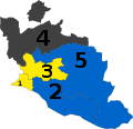
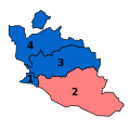
1T Législatives 2017 Vaucluse.svg 870 × 843; 8 KB
-
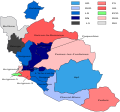
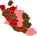
1T Législatives 2022 Vaucluse communes.svg 1,000 × 968; 71 KB
-
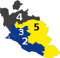
2T Législatives 2017 Vaucluse.svg 933 × 904; 8 KB
-
2T Législatives 2022 Vaucluse communes.svg 1,000 × 968; 71 KB
-
2T Législatives 2022 Vaucluse.svg 933 × 904; 10 KB
-
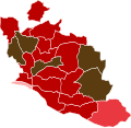
2T Législatives 2024 Vaucluse.svg 933 × 904; 10 KB
-
Blank Map of Vaucluse Department, France, with Communes.svg 1,000 × 968; 60 KB
-
Cantons de Vaucluse 2021.svg 643 × 600; 82 KB
-
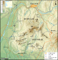
Carte des Dentelles de Montmirail.svg 1,018 × 1,067; 1.99 MB
-
Carte du Comtat Venaissin.svg 895 × 865; 168 KB
-
Députés sortants du Vaucluse en 2017.svg 4,549 × 4,404; 8 KB
-
France Vaucluse simplified map.svg 2,456 × 2,204; 29 KB
-
Législatives 1956 Vaucluse cantons blocs.svg 1,000 × 968; 23 KB
-
Législatives 1956 Vaucluse cantons listes.svg 1,000 × 968; 23 KB
-
Railway map of France - 84 - 1870 - fr - small.svg 564 × 861; 4.25 MB
-
Railway map of France - 84 - 1900 - fr - small.svg 564 × 861; 4.41 MB
-
Railway map of France - 84 - 1930 - fr - small.svg 564 × 861; 4.5 MB
-
Railway map of France - 84 - 1980 - fr - small.svg 564 × 861; 4.49 MB
-
Railway map of France - 84 - 2020 - fr - small.svg 564 × 861; 4.31 MB
-
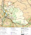
Transport map of France - 84.svg 744 × 850; 8.88 MB
-
Vaucluse - Apt arrondissement.svg 730 × 708; 278 KB
-
Vaucluse - Avignon arrondissement.svg 730 × 708; 278 KB
-
Vaucluse - Carpentras arrondissement.svg 730 × 708; 278 KB
-
Vaucluse department location map.svg 1,018 × 978; 353 KB
-
Vaucluse et provinces.svg 1,307 × 1,138; 170 KB
-
Vaucluse location map.svg 1,929 × 1,847; 363 KB
-
Vaucluse législatives 1958.svg 1,032 × 1,000; 11 KB
-
Vaucluse législatives 1962.svg 1,032 × 1,000; 11 KB
-
Vaucluse législatives 1967.svg 1,032 × 1,000; 11 KB
-
Vaucluse législatives 1973.svg 1,032 × 1,000; 11 KB
-
Vaucluse législatives 1978.svg 1,032 × 1,000; 10 KB
-
Vaucluse législatives 1981.svg 1,032 × 1,000; 10 KB
-
Vaucluse élus 1988.svg 800 × 800; 8 KB
-
Vaucluse élus 1993.svg 800 × 800; 8 KB
-
Vaucluse élus 1997.svg 800 × 800; 8 KB
-
Vaucluse élus 2007.svg 800 × 800; 8 KB
-
Vaucluse-Position.svg 507 × 553; 145 KB


