Category:SVG maps of Andhra Pradesh
Jump to navigation
Jump to search
States of India: Andhra Pradesh · Arunachal Pradesh · Assam · Bihar · Chhattisgarh · Goa · Gujarat · Haryana · Himachal Pradesh · Jharkhand · Karnataka · Kerala · Madhya Pradesh · Maharashtra · Manipur · Meghalaya · Mizoram · Nagaland · Odisha · Punjab · Rajasthan · Sikkim · Tamil Nadu · Telangana · Tripura · Uttar Pradesh · Uttarakhand · West Bengal
Union territories: Andaman and Nicobar Islands · Chandigarh · Dadra and Nagar Haveli and Daman and Diu · Delhi · Jammu and Kashmir · Ladakh · Lakshadweep · Puducherry
Former states of India: Jammu and Kashmir ·
Former union territories:
Union territories: Andaman and Nicobar Islands · Chandigarh · Dadra and Nagar Haveli and Daman and Diu · Delhi · Jammu and Kashmir · Ladakh · Lakshadweep · Puducherry
Former states of India: Jammu and Kashmir ·
Former union territories:
Subcategories
This category has the following 2 subcategories, out of 2 total.
!
S
Media in category "SVG maps of Andhra Pradesh"
The following 29 files are in this category, out of 29 total.
-
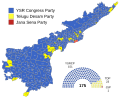
2024 Andhra Pradesh Legislative Assembly Election Results Map.svg 974 × 787; 366 KB
-
2024 Lok Sabha Andhra Pradesh Result Map.svg 1,124 × 919; 248 KB
-
Andhra Pradesh 2019 te.svg 1,030 × 850; 510 KB
-
Andhra Pradesh districts map from 2 June 2014-hi.svg 4,387 × 3,690; 243 KB
-
Andhra Pradesh districts map from 2 June 2014.svg 4,679 × 3,936; 226 KB
-
Andhra Pradesh election 2019 parliament diagram.svg 1,030 × 850; 610 KB
-
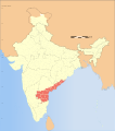
Andhra Pradesh in India.svg 1,500 × 1,615; 1.56 MB
-
Andhra Pradesh map for WLM-IN.svg 667 × 541; 26 KB
-
Andhra Pradesh outline.svg 685 × 639; 25 KB
-
Andhra Pradesh Wahlkreise Lok Sabha (2014-).svg 660 × 550; 1.08 MB
-
Andhra Pradesh WV.svg 1,027 × 849; 615 KB
-
Badami-chalukya-empire-map.svg 1,510 × 1,753; 339 KB
-
Bahamani-sultanate-map.svg 1,521 × 1,761; 334 KB
-
Bijapur-sultanate-map.svg 1,651 × 1,753; 432 KB
-
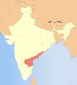
India Andhra Pradesh location map (current).svg 1,027 × 849; 358 KB
-
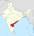
India Andhra Pradesh locator map (PlaneMad edition).svg 1,574 × 1,738; 966 KB
-
India Andhra Pradesh locator map.svg 580 × 641; 6.93 MB
-
India Andhra Pradesh relief map.svg 1,027 × 849; 1.32 MB
-
India Seemandhra locator map.svg 1,643 × 1,854; 1.08 MB
-
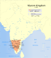
Indian Mysore Kingdom 1784 map-es.svg 1,639 × 1,852; 2.44 MB
-
Indian Mysore Kingdom 1784 map.svg 1,639 × 1,852; 476 KB
-
Madras 1951 Vanniyar.svg 756 × 716; 211 KB
-
Regions of Andhra Pradesh.svg 1,454 × 1,202; 964 KB
-
Vijayanagara-empire-map.svg 1,585 × 1,850; 372 KB
-
Wahlkreise zur Vidhan Sabha von Andhra Pradesh (2014-).svg 974 × 787; 363 KB
-
Western-chalukya-empire-map.svg 1,510 × 1,753; 426 KB
-
Western-ganga-empire-map.svg 1,651 × 1,753; 430 KB
-
অন্ধ্রপ্রদেশের লোকসভা কেন্দ্র.svg 660 × 550; 1.2 MB


