Category:SVG maps of Kerala
Jump to navigation
Jump to search
States of India: Andhra Pradesh · Arunachal Pradesh · Assam · Bihar · Chhattisgarh · Goa · Gujarat · Haryana · Himachal Pradesh · Jharkhand · Karnataka · Kerala · Madhya Pradesh · Maharashtra · Manipur · Meghalaya · Mizoram · Nagaland · Odisha · Punjab · Rajasthan · Sikkim · Tamil Nadu · Telangana · Tripura · Uttar Pradesh · Uttarakhand · West Bengal
Union territories: Andaman and Nicobar Islands · Chandigarh · Dadra and Nagar Haveli and Daman and Diu · Delhi · Jammu and Kashmir · Ladakh · Lakshadweep · Puducherry
Former states of India: Jammu and Kashmir ·
Former union territories:
Union territories: Andaman and Nicobar Islands · Chandigarh · Dadra and Nagar Haveli and Daman and Diu · Delhi · Jammu and Kashmir · Ladakh · Lakshadweep · Puducherry
Former states of India: Jammu and Kashmir ·
Former union territories:
Subcategories
This category has only the following subcategory.
Media in category "SVG maps of Kerala"
The following 78 files are in this category, out of 78 total.
-
2011 Kerala election result.svg 1,035 × 1,032; 3.31 MB
-
2016 Kerala election result.svg 1,104 × 1,101; 1.36 MB
-
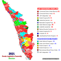
2021 Kerala election result.svg 1,035 × 1,032; 3.41 MB
-
2024 Lok Sabha Kerala Result Map.svg 510 × 694; 1.12 MB
-
2024 Lok Sabha Kerala Seatwise Result Map.svg 510 × 694; 1.12 MB
-
Administrative Divisions of Kerala (2020).svg 1,123 × 1,588; 1.46 MB
-
Alappuzha district location map.svg 700 × 766; 1.72 MB
-
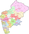
Assembly constituencies and Municipalities of Malappuram district (August 2020).svg 1,148 × 1,206; 887 KB
-
Badami-chalukya-empire-map.svg 1,510 × 1,753; 339 KB
-
Constituencies in Kerala for the Lok Sabha 2014.svg 1,569 × 2,692; 82 KB
-
Constituency wise Loksabha Results 2019 - Kerala.svg 432 × 651; 756 KB
-
Distribution of Population in Malappuram District.svg 1,415 × 1,670; 2.62 MB
-
Districts of Kerala.svg 617 × 786; 2.03 MB
-
Ernakulam district location map.svg 700 × 766; 1.72 MB
-
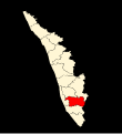
Idukki district location map.svg 700 × 766; 1.72 MB
-
India Central Travancore locator map.svg 1,639 × 1,852; 795 KB
-
India Kerala districts numbered.svg 827 × 1,205; 72 KB
-
India Kerala location map.svg 874 × 1,274; 350 KB
-
India Kerala relief map.svg 874 × 1,274; 1.2 MB
-
India Kerala.svg 1,500 × 1,615; 1.46 MB
-
India Travancore locator map.svg 1,639 × 1,852; 795 KB
-
India-KERALA.svg 1,486 × 1,734; 426 KB
-
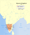
Indian Mysore Kingdom 1784 map-es.svg 1,639 × 1,852; 2.44 MB
-
Indian Mysore Kingdom 1784 map.svg 1,639 × 1,852; 476 KB
-
Kanhangad.svg 1,164 × 778; 1.4 MB
-
KanhangadLSGI.svg 775 × 1,038; 1.27 MB
-
Kannur district location map.svg 700 × 766; 1.72 MB
-
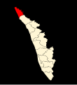
Kasaragod district location map.svg 700 × 766; 1.72 MB
-
Kerala and Tamil Nadu - combined district map.svg 553 × 368; 353 KB
-
KERALA CONSTITUENCIES WITH DISTRICT BOUNDARIES.svg 2,105 × 2,980; 3.01 MB
-
Kerala Constituency wise Loksabha Results 2009.svg 432 × 651; 790 KB
-
Kerala Constituency wise Loksabha Results 2014.svg 432 × 651; 801 KB
-
Kerala Constituency wise Loksabha Results 2019.svg 510 × 694; 1.13 MB
-
Kerala ecozones map labelled3.svg 744 × 1,052; 160 KB
-
Kerala locator map.svg 1,340 × 1,627; 151 KB
-
Kerala map for WLM-IN.svg 457 × 759; 140 KB
-
Kerala-administrative-divisions-map-en.svg 2,700 × 3,000; 395 KB
-
Kerala-map-ml.svg 1,429 × 2,500; 254 KB
-
Kerala-road-map-ml.svg 2,000 × 2,556; 104 KB
-
KeralaBlankMap.svg 457 × 759; 4.55 MB
-
KERALASH22.svg 725 × 2,875; 667 KB
-
KERALASH61.svg 1,098 × 268; 178 KB
-
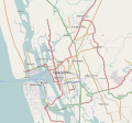
Kochi India area locator map.svg 844 × 788; 851 KB
-
Kollam district location map.svg 700 × 766; 1.72 MB
-
Kollam.svg 1,244 × 906; 210 KB
-
Kottayam district location map.svg 700 × 766; 1.72 MB
-
Kozhikode district in 1961.svg 792 × 1,135; 1.43 MB
-
Kozhikode district location map.svg 700 × 766; 1.72 MB
-
Legislative assembly constituencies in Kerala.svg 3,283 × 3,725; 2.47 MB
-
Legislative Assembly constituencies of Kerala (blank).svg 580 × 1,102; 1.56 MB
-
Legislative Assembly Constituencies of Malappuram 1.svg 1,510 × 1,782; 301 KB
-
Legislative Assembly Constituencies of Malappuram.svg 1,510 × 1,782; 1.37 MB
-
Legislative Assembly constituencies of Palakkad.svg 1,935 × 2,009; 1.4 MB
-
Local Self Governance in Kannur District.svg 905 × 639; 3.04 MB
-
Local Self Governance in Kasaragod District.svg 1,041 × 1,533; 13.94 MB
-
Local self-government institutions in Malappuram.svg 1,591 × 1,996; 644 KB
-
Malabar District (1951 Census).svg 1,164 × 1,655; 3.24 MB
-
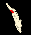
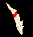
Malappuram district location map.svg 700 × 766; 1.72 MB
-
Map of Malappuram District (April 2021).svg 1,018 × 1,327; 16.21 MB
-
Palakkad district location map.svg 700 × 766; 1.72 MB
-
Pathanamthitta district location map.svg 700 × 766; 1.72 MB
-
Political map of Kerala.svg 1,205 × 1,671; 441 KB
-
Regions of Kerala.svg 1,130 × 1,566; 741 KB
-
Road Network Kerala.svg 713 × 919; 109 KB
-
Subdistricts of Idukki (2020).svg 834 × 778; 492 KB
-
Tamil speakers map.svg 1,639 × 1,852; 260 KB
-
The districts of Kerala-ar.svg 830 × 880; 2.62 MB
-
The districts of Kerala.svg 830 × 880; 2.62 MB
-
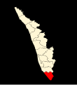
Thiruvananthapuram district location map.svg 700 × 766; 1.72 MB
-
Thrissur district location map.svg 700 × 766; 1.72 MB
-
Vijayanagara-empire-map.svg 1,585 × 1,850; 372 KB
-
Wahlkreise zur Vidhan Sabha von Kerala.svg 845 × 1,150; 1.55 MB
-
Wayanad district location map.svg 700 × 766; 1.72 MB
-
Western-Ghats-rainfall.svg 600 × 1,000; 308 KB
-
Wikidata Kerala.svg 1,429 × 2,500; 49 KB
-
কেরালার লোকসভা কেন্দ্র.svg 510 × 694; 1.13 MB
-
கேரளம் அரசியல் வரைபடம்.svg 512 × 710; 768 KB


