Category:Rail transport maps of Turkey
Jump to navigation
Jump to search
Subcategories
This category has the following 3 subcategories, out of 3 total.
Media in category "Rail transport maps of Turkey"
The following 61 files are in this category, out of 61 total.
-
1911 - Sketch map to shew approximately railways in Asiatic Turkey.jpg 5,939 × 4,211; 3.02 MB
-
1918-1919 Map of Railroads in Turkey by the American Commission to Negotiate Peace.jpg 10,232 × 6,464; 5.84 MB
-
1936 Türkiye demiryolları haritası.jpg 999 × 548; 423 KB
-
2. Abdülhamit devri demiryolları.JPG 1,541 × 1,094; 147 KB
-
Ankara Sivas YHT.png 2,438 × 1,167; 220 KB
-
Ankara-Istanbul HSR map.png 4,961 × 3,508; 3.08 MB
-
Ankara-Sivas YHT.png 4,915 × 2,963; 4.17 MB
-
Ankara-Sivas YHT.svg 400 × 100; 21 KB
-
Bahnstrecke Sivas–Samsun.png 6,181 × 7,087; 2.21 MB
-
Baku-Tbilisi-Kars Railway Map.svg 948 × 645; 12.83 MB
-
Bursa-Mudanya Rail Map.GIF 545 × 364; 7 KB
-
Cenup Demiryolları.GIF 2,828 × 1,300; 48 KB
-
CFAB Map (1927).png 4,877 × 2,599; 515 KB
-
CFOA Map (1912).png 4,881 × 2,599; 500 KB
-
Chemin de fer de Smyrne–Cassaba et Prolongements.png 2,816 × 1,862; 927 KB
-
Chemin de fer Franco-Hellenique.png 5,027 × 5,748; 3.21 MB
-
Chemin de fer Franco-Hellenique2 en.png 5,027 × 5,748; 3.15 MB
-
Chester Consessions map.jpg 2,300 × 1,404; 616 KB
-
Die Türkei und die Bagdadbahn 1915. Zeitgenössische Vogelschauperspektive.jpg 4,205 × 2,558; 5.29 MB
-
Distribution of Mineral Products & Railways of Asia Minor - NARA - 109182071.jpg 5,152 × 4,185; 2.08 MB
-
Edirne railway map.png 936 × 548; 21 KB
-
High speed rail turkey.jpg 1,095 × 587; 62 KB
-
High Speed Rail Turkey.PNG 2,438 × 1,167; 91 KB
-
II. Abdülhamit dönemi demiryolları-es.svg 1,024 × 741; 550 KB
-
II. Abdülhamit dönemi demiryolları.svg 1,024 × 741; 257 KB
-
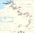
Irmak–Karabük–Zonguldak.png 3,500 × 3,380; 868 KB
-
Istanbul-Ankara railway map.png 4,961 × 3,508; 3.11 MB
-
Izmir-Afyon railway map.png 4,961 × 2,219; 1.67 MB
-
Koch Opitz 1905 Balkan 13679078.webp 5,127 × 3,929; 3.32 MB
-
Körfez Ulastirma.png 4,877 × 2,599; 533 KB
-
LGV Ankara-Istanbul.png 2,438 × 1,167; 160 KB
-
LGV Ankara-Konya.png 2,438 × 1,167; 160 KB
-
LGV Ankara-Sivas.png 2,438 × 1,167; 133 KB
-
Map of Samsun Çarsamba line. Drawing JP Charrey.gif 864 × 645; 12 KB
-
Map of the Asian provinces of the Ottoman Empire by Heinrich Kiepert.tif 17,757 × 11,641; 591.45 MB
-
Map of the Kars-Akhalkalaki-Tbilisi-Baku railway.png 1,742 × 1,076; 2.34 MB
-
ORC Map (1912).png 4,881 × 2,599; 497 KB
-
ORC Railway Map.GIF 2,828 × 1,300; 49 KB
-
Ottoman Railway Company.png 3,248 × 1,190; 911 KB
-
Polatli-Konya HSR Map.png 4,107 × 3,508; 2.52 MB
-
Rail transport map of Turkey in Turkish.png 3,656 × 1,750; 784 KB
-
Rail transport map of Turkey-m.png 3,656 × 1,750; 788 KB
-
Rail transport map of Turkey.png 3,656 × 1,750; 789 KB
-
Railway map of South East Europe.png 5,405 × 5,290; 5.05 MB
-
Roell-1912 Karte der Türkischen Eisenbahnen.jpg 2,288 × 1,680; 452 KB
-
Samsun - Sivas Demiryolu Haritası.png 523 × 600; 37 KB
-
SCP 1912.gif 800 × 368; 32 KB
-
SCP Map (1912).png 4,881 × 2,599; 498 KB
-
TCDD 1929 map.png 2,828 × 1,300; 80 KB
-
TCDD Network Map 2023.svg 512 × 250; 757 KB
-
Tcdd network.png 3,539 × 1,627; 867 KB
-
TCDD System Map.GIF 2,828 × 1,300; 397 KB
-
TCDD.svg 3,535 × 1,625; 103 KB
-
Turkey High Speed Rail.png 1,701 × 716; 540 KB
-
Turkish railways in 1918.jpg 1,852 × 1,092; 260 KB
-
YHT Service.png 4,961 × 3,508; 5.27 MB
-
YHT Turkey 1741x733.png 2,469 × 1,431; 435 KB


