Category:Rail transport maps of Taiwan
Jump to navigation
Jump to search
Subcategories
This category has the following 8 subcategories, out of 8 total.
H
M
R
T
Media in category "Rail transport maps of Taiwan"
The following 36 files are in this category, out of 36 total.
-
167km-Taiwan-railway-map.PNG 576 × 324; 11 KB
-
1942 Map of TAIWAN Tourism 臺灣旅遊地圖.jpg 1,409 × 2,047; 1.18 MB
-
Arashiyama Mountain railway Route map.png 1,649 × 802; 53 KB
-
Daitotei railway map.jpg 260 × 180; 28 KB
-
HengchunLine.png 244 × 799; 64 KB
-
Kagi Hokko Kobi Railway Map.JPG 2,048 × 1,536; 887 KB
-
Map of Puli to Yuchi 01.jpg 1,938 × 2,204; 869 KB
-
Map of Puli to Yuchi.jpg 694 × 702; 112 KB
-
Map of railway lines in Taiwan in Qing Dynasty.jpg 1,600 × 1,200; 882 KB
-
Maps of railways between Chikunan and Kiirun.jpg 2,511 × 4,009; 2.44 MB
-
Nitaka Port Line.JPG 2,048 × 1,536; 685 KB
-
Public transport map of Taiwan 1936.jpg 3,642 × 4,136; 2.32 MB
-
Public transportation map of Taiwan in 1927.jpg 4,709 × 9,803; 71.6 MB
-
Rail transport map of Formosa by the Railway Ministry in 1937.jpg 2,744 × 3,950; 1.12 MB
-
Rail transport map of Taiwan in 1938 01.jpg 3,632 × 5,456; 5.66 MB
-
Rail transport map of Taiwan in 1938 02.jpg 3,632 × 5,456; 5.56 MB
-
Railway map Japanese Taiwan.jpg 550 × 1,225; 223 KB
-
Railways at Kaohsiung EN.jpg 377 × 424; 40 KB
-
Railways at Kaohsiung JP.jpg 736 × 828; 225 KB
-
Railways at Kaohsiung.jpg 377 × 424; 32 KB
-
Railways at Kaohsiung.svg 434 × 534; 132 KB
-
Shinei Hokumon Sobun Railway Map.JPG 2,048 × 1,536; 859 KB
-
Taihoku Tetsudo Line.JPG 2,048 × 1,536; 697 KB
-
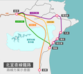
Taipei-Yilan New Railway Plan Map.png 1,841 × 1,642; 212 KB
-
Taiwan daily news taiwan map.jpg 3,313 × 601; 1.07 MB
-
Taiwan Railway map cartoon style.jpg 838 × 1,236; 231 KB
-
Taoyuan Railway Elevated Planning 20151030.svg 512 × 235; 28 KB
-
TRA Neiwan Line and Liujia Line route map 20160616.jpg 4,608 × 3,456; 3.27 MB
-
TRA North Area Route Map at Xizhi Station 20170224.jpg 3,200 × 1,800; 695 KB
-
TRA North Area Route Map at Xizhi Station 20170405.jpg 3,840 × 2,160; 1.14 MB
-
TRA Pingsi Line tourist guide light box at Rueifang Station 20020818.jpg 2,048 × 1,536; 1.04 MB
-
日治臺灣鐵道地圖 Map of TAIWAN Railways before 1945.jpg 502 × 1,200; 286 KB
-
臺灣蕃地圖.jpg 2,214 × 3,053; 2.55 MB
-
臺灣蕃族分布圖.jpg 3,712 × 5,404; 1.46 MB
-
西南部海岸線路圖.jpg 907 × 1,481; 1.05 MB


