Category:Rail transport maps of Europe
Jump to navigation
Jump to search
Subcategories
This category has the following 57 subcategories, out of 57 total.
Media in category "Rail transport maps of Europe"
The following 111 files are in this category, out of 111 total.
-
2014-GareCornavin-Hall2.jpg 2,592 × 1,944; 1.34 MB
-
Bahnhöfe in Europa.png 1,024 × 768; 321 KB
-
Bahnstrecke feldkirch buchs.png 710 × 507; 330 KB
-
Balkanzug route.svg 1,200 × 900; 62 KB
-
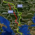
Belgrade Budapest HSR.png 299 × 429; 40 KB
-
Busiest Railway Stations in Europe.jpg 1,414 × 1,752; 518 KB
-
Carte generale des chemins de fer de l'Europe Centrale 1853.pdf 9,895 × 12,395, 2 pages; 2.68 MB
-
Chemins de fer d'Europe, principalement de Londres et Paris à Basiasch sur le Danube.jpg 11,681 × 4,699; 8.62 MB
-
City Night Line network 2010-2011.svg 815 × 964; 26 KB
-
EC D.png 693 × 952; 90 KB
-
Eisenbahn und Weltzeit-Karte Mittel-Europas - von Emil Plechawski - btv1b53022713x.jpg 14,403 × 11,713; 27.52 MB
-
Eisenbahn- und Dampschiffrouten-Karte von Europa - bearbeitet von J. Franz - btv1b53093089c.jpg 22,062 × 17,053; 55.66 MB
-
Eisenbahn-Geschichtskarte von Mitteleuropa - entworfen von H. Struve... - btv1b53057339k.jpg 5,146 × 8,100; 5.98 MB
-
Eisenbahn-und Dampfschiffrouten-Karte von Europa - bearbeitet von J. Franz - btv1b530326952.jpg 21,463 × 16,476; 54.4 MB
-
Eisenbahn-und Dampfschiffrouten-Karte von Europa.jpg 21,463 × 16,476; 56.87 MB
-
Eisenbahn-und-Dampfschiff-routen-Karte von Europa - bearbeitet von J. Franz - btv1b532394204.jpg 22,125 × 16,963; 61.44 MB
-
Eisenbahnen-Telegrafen-Mitteleuropa-um1850.jpg 1,843 × 1,418; 1.54 MB
-
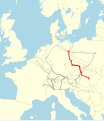
ERTMS-Korridor A.PNG 580 × 783; 50 KB
-
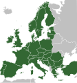
Eurail Global Pass Participating Countries.svg 680 × 520; 755 KB
-
Eurocity Hungaria 2010.svg 1,040 × 1,203; 51 KB
-
Eurocity Network 1987 summer.svg 1,040 × 1,203; 49 KB
-
Eurocity Network 2010 winter.svg 1,040 × 1,203; 47 KB
-
Europe rail 1927.JPG 3,068 × 2,289; 2.35 MB
-
Europe rail electrification de.svg 688 × 520; 401 KB
-
Europe rail electrification en.svg 688 × 520; 400 KB
-
Europe rail electrification.png 1,790 × 1,625; 522 KB
-
Europe trip rail route sample.jpg 1,430 × 1,004; 188 KB
-
European railtrafficregions.png 891 × 782; 28 KB
-
European Sleeper map.svg 652 × 472; 416 KB
-
Eurostar map.svg 751 × 754; 820 KB
-
First-railway-Europe-country.jpg 2,519 × 1,701; 478 KB
-
Galician Transversal Railway 1904.jpg 3,016 × 1,765; 8.57 MB
-
Güterverkehrskorridore 1 und 2.PNG 1,140 × 1,536; 659 KB
-
International trains from Belgium 1933.jpg 2,200 × 1,710; 1.21 MB
-
International trains map Belgium.svg 843 × 665; 242 KB
-
International trains map the Netherlands.svg 574 × 560; 270 KB
-
Internationale Endbahnhöfe ab Wien Hbf.png 1,319 × 1,024; 5.16 MB
-
InterRail Global Pass countries gold.svg 645 × 690; 262 KB
-
InterRail Global Pass countries.svg 645 × 690; 260 KB
-
Landkarte europäischer Eisenbahnen.jpg 2,346 × 1,956; 201 KB
-
Lenin Sealed Train Map-pl.svg 273 × 340; 503 KB
-
Liberalization of European passenger rail market.svg 454 × 450; 477 KB
-
Liberalization of European rail market.svg 454 × 450; 366 KB
-
Map Europe railway platform height.svg 680 × 520; 319 KB
-
Map Network RFCorridors.jpg 3,539 × 2,410; 1.04 MB
-
Map night trains in europe.png 6,299 × 6,299; 4.42 MB
-
Map of electrified railways in Northern Europe.jpg 1,558 × 739; 363 KB
-
MAP OF EUROPE LOC hec.04605.jpg 10,153 × 7,586; 11.64 MB
-
MAP OF EUROPE LOC hec.04605.tif 10,153 × 7,586; 146.92 MB
-
MAP OF EUROPE LOC hec.04606.jpg 10,186 × 7,627; 13.24 MB
-
MAP OF EUROPE LOC hec.04606.tif 10,186 × 7,627; 148.2 MB
-
Map of High Speed Railroad in Czechia and neighbourhood.png 1,880 × 1,280; 418 KB
-
Map of Reykjavík Harbour Railway.jpg 1,125 × 636; 285 KB
-
Map of the Sandschak railroad, 1917.jpg 1,364 × 1,840; 400 KB
-
Mappa Ferrovie Europa.svg 660 × 870; 1.77 MB
-
Mehrwertsteuer Bahntickets EU.jpg 376 × 355; 32 KB
-
Modern and contemporary European history (1815-1921) (1922) (14784077812).jpg 1,612 × 2,224; 703 KB
-
Msk-spb railway.PNG 447 × 506; 129 KB
-
Nachtreinen NL 2013.png 767 × 757; 62 KB
-
Navigation à vapeur dans le bassin de la Méditerranée et chemins de fer de l'Europe Central 1872.tif 12,519 × 8,442; 302.42 MB
-
Networks of Major High Speed Rail Operators in Europe.gif 1,980 × 1,316; 999 KB
-
Niederschlesisch-Märkische Eisenbahn.jpg 800 × 492; 296 KB
-
Nord Express before WW1.svg 1,600 × 1,000; 88 KB
-
Nord Express Interwar period.svg 1,600 × 1,000; 95 KB
-
OEBB Nachtzug Strecken streckennetz deutsch 2022.png 6,000 × 3,378; 1.4 MB
-
OEBB Nachtzug Strecken streckennetz deutsch 2023.png 3,000 × 1,689; 426 KB
-
Oostende-Wien Express 1894.svg 1,200 × 900; 47 KB
-
Orient Express 88 Paris-Tokyo.svg 1,900 × 1,000; 216 KB
-
Orient-Express 1919-1939 - SAVE and OWOE.png 2,369 × 1,806; 3.02 MB
-
Orient-Express 1919-1939.png 2,352 × 1,790; 3.23 MB
-
Pp22 new old.png 1,097 × 1,097; 2.63 MB
-
RAe rayon TEE.jpg 928 × 828; 119 KB
-
Rail gauge EurAsia.png 803 × 507; 149 KB
-
Rail left right side Map of Europe.svg 680 × 520; 597 KB
-
Railroad Map Europe Main Lines.gif 1,793 × 1,316; 245 KB
-
Railroads of Eastern Europe - 1952 - DPLA - 28ebf34dae691d77e75bb07de85b506d (page 1).jpg 11,973 × 8,817; 13.93 MB
-
Railteam Network 08.gif 1,600 × 1,349; 213 KB
-
Railway Cy map.jpg 4,773 × 2,870; 8.47 MB
-
Railway map of South East Europe.png 5,405 × 5,290; 5.05 MB
-
Railwayneteurope1896.JPG 1,244 × 1,032; 318 KB
-
Roell-1912 Karte der Donau-Adriatischen Eisenbahnen.jpg 1,950 × 2,950; 842 KB
-
Sibirjak.png 460 × 250; 4 KB
-
The train route from China to Europe.png 1,683 × 848; 1,003 KB
-
Trans-Eurasia-Express.png 1,358 × 590; 362 KB
-
Transalpina.png 600 × 897; 80 KB
-
Transpol.jpg 938 × 687; 100 KB
-
Transports européens 2005 Rail.jpg 1,093 × 1,567; 373 KB
-
Vienna broad g1.png 1,107 × 1,000; 356 KB
-
Zone Interrail.png 1,360 × 1,245; 87 KB


