Category:Transport maps of Europe
Jump to navigation
Jump to search
Subcategories
This category has the following 17 subcategories, out of 17 total.
*
A
- Aviation maps of Europe (14 F)
C
E
G
M
- Maps of EuroVelo (28 F)
- Maps of Grand Tours of Europe (11 F)
O
P
S
- Speed limit maps of Europe (9 F)
Media in category "Transport maps of Europe"
The following 86 files are in this category, out of 86 total.
-

-
 1939 Intourist Map of The Soviet Union and Europe Showing Principal Transportation Connections.jpg 14,458 × 10,630; 44.75 MB
-
 Aachen-Frankfurter Heerstraße.jpg 1,007 × 537; 129 KB
-
 Amber Road.jpg 2,247 × 3,276; 1.27 MB
-
 Bristol trade routes1492.png 1,735 × 1,761; 330 KB
-
 Bursztynowy szlak.jpg 2,226 × 2,967; 733 KB
-
 Car regulations for daytime running light in Europe.png 1,828 × 1,912; 36 KB
-
 CarteRoulEurope.jpg 994 × 1,176; 196 KB
-
 Color of European Motorway Signs.svg 645 × 690; 354 KB
-
 Container deposit legislation in Europe.png 1,200 × 1,000; 50 KB
-
 Core Road Network - South Eastern Europe.png 1,414 × 1,054; 670 KB
-
 Countries of Europe driving on the left or right.svg 680 × 520; 799 KB
-
 Croquis Northern Range, 7.png 3,500 × 1,762; 282 KB
-
 Doornik handelsroutes.jpg 1,366 × 1,258; 865 KB
-
 E79 en new.png 517 × 518; 108 KB
-
 E79.png 800 × 722; 155 KB
-
 Eisenbahnen-Telegrafen-Mitteleuropa-um1850.jpg 1,843 × 1,418; 1.54 MB
-
 EU air carrier restrictions map.svg 2,754 × 1,398; 1.06 MB
-
 Europe busiest airports.png 1,475 × 1,200; 681 KB
-
 Europe Completed Motorways Dec 2012.png 2,000 × 1,604; 507 KB
-
 Europe Completed Motorways.png 2,000 × 1,604; 507 KB
-
 European countries with left-hand or right-hand traffic.png 3,592 × 3,192; 1.14 MB
-
 European railtrafficregions.png 891 × 782; 28 KB
-
 European trafficregions.png 942 × 917; 32 KB
-
 EuropeCent.PNG 946 × 786; 391 KB
-
 EuroVelo Route 6 map.svg 1,116 × 764; 870 KB
-
 Eurowhiff map.png 231 × 143; 26 KB
-
 Flight CSA 540-ar.png 1,600 × 1,132; 532 KB
-
 Flight CSA 540.png 1,600 × 1,132; 523 KB
-
 Flight JAT367.png 1,280 × 924; 437 KB
-
 Highway speed limits europe with indicator colors.png 1,561 × 1,000; 398 KB
-
 Hinterland Anvers.JPG 960 × 720; 39 KB
-
 Hyperloop Standarization.png 1,146 × 780; 454 KB
-
 Hyperloop VisionForEurope.png 1,300 × 1,000; 1.41 MB
-
 Interflug foreign flight connections 1973.svg 1,059 × 1,265; 63 KB
-
 Ipeet.jpg 476 × 452; 45 KB
-
 Itineraire.JPG 324 × 259; 29 KB
-
 Itinerario de la línea 35 de EMT Valencia.JPG 1,000 × 356; 91 KB
-
 Jakob Lines routes.png 669 × 445; 38 KB
-
 Jerusalemweg.jpg 1,629 × 1,162; 352 KB
-
 Kanal DOL.jpg 960 × 720; 69 KB
-
 Kolejowe korytarze transportowe OSŻD.png 605 × 339; 426 KB
-
 Logistics Designer.png 740 × 632; 812 KB
-
 Map of European Air Routes in 1925.jpg 1,788 × 1,236; 459 KB
-
 Map-tanker-trade-routes-after-sanctions.png 763 × 521; 320 KB
-
 Mapa A Diogneto.png 679 × 450; 94 KB
-
 Montenegro bus accident.png 496 × 404; 101 KB
-
 North-South Transport Corridor map (RU).svg 1,088 × 851; 4.27 MB
-
 Northern Range croquis.png 850 × 532; 102 KB
-
 One Big Lift (2nd Armored Division) -53067-2009-10-14-171055.jpg 3,517 × 2,472; 902 KB
-
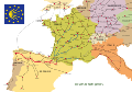
 Pan-European corridor VIII de.png 800 × 541; 490 KB
-
 Pan-European corridor VIII mk.svg 392 × 486; 559 KB
-
 Pan-European corridor X.svg 392 × 486; 559 KB
-
 Pan-European corridors de.svg 392 × 486; 555 KB
-
 Pan-European corridors mk.svg 392 × 486; 562 KB
-
 Pan-European corridors ru.svg 392 × 486; 847 KB
-
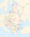 Pan-European corridors.svg 392 × 486; 561 KB
-
 Paneuropetransport.png 773 × 942; 32 KB
-
 Postkurse 1563.jpg 3,205 × 2,297; 614 KB
-
 Postkurse 1711.jpg 1,372 × 1,128; 509 KB
-
 Red Europea de Carreteras.png 805 × 586; 131 KB
-
 Rutas Eurovelo enteras.png 800 × 852; 259 KB
-
 Ryanairdestinations.png 600 × 528; 30 KB
-
 Smaland airport regualr destinations.pdf 1,752 × 1,881; 81 KB
-
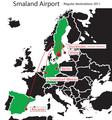
 Smaland airport regualr destinations.svg 394 × 426; 115 KB
-
 Sonora Korridore.jpg 1,001 × 1,024; 111 KB
-
 Strecke europa 2.JPG 741 × 546; 134 KB
-
 Strecke europa.jpg 2,920 × 2,177; 783 KB
-
 Subway in Europe.png 2,839 × 2,619; 885 KB
-
 Trans-European Transport Network (2024).png 9,932 × 10,681; 23.79 MB
-
 Trans-European Transport Network (2024, not final).jpg 9,934 × 14,032; 4.83 MB
-
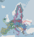
 Trans-European Transport Network.jpg 1,424 × 1,350; 159 KB
-
 Vehicle registration plates in Europe.jpg 2,802 × 2,745; 2.16 MB
-
 Vehicle registration plates in Europe.png 1,800 × 1,539; 2.78 MB
-
 Vercors geo territories roads map-fr.svg 1,350 × 1,700; 287 KB
-
 Via domitia map600x600 (1).png 600 × 600; 58 KB
-
 Via Imperii und Via Regia.png 1,286 × 938; 226 KB
-
 Via Imperii.png 376 × 580; 47 KB
-
 Via Regia und Via Imperii - hsb.png 1,286 × 938; 231 KB
-
 Viking Age trade routes in north-west Europe.png 994 × 967; 441 KB
-
 Vodní koridor D-O-L z pohledu evropské dopravní sítě TEN-T.png 1,228 × 733; 1.88 MB
-
 Ways of St-2. James in Europe Workaround.svg 512 × 360; 171 KB
-
 Ways of St-2. James in Europe.svg 2,955 × 2,080; 1.94 MB
-
 ZoRCoCuK Travel Planning Map.png 2,100 × 1,525; 90 KB
-
 Zustellkarte HLG.jpg 395 × 425; 35 KB
-
 Мапа транспортного коридору(УКР).png 1,280 × 1,280; 1.05 MB


_-53067-2009-10-14-171055.jpg)


.png)


.png)
.svg)
.png)
.jpg)