Category:Maps of Germania magna
Jump to navigation
Jump to search
English: Not to be confused with Maps of Greater Germany
Subcategories
This category has the following 5 subcategories, out of 5 total.
Media in category "Maps of Germania magna"
The following 20 files are in this category, out of 20 total.
-
1513 Quarta Europae Tabula FLEVVM.jpg 554 × 405; 295 KB
-
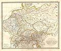
1865 Spruner Map of Germany in Antiquity - Geographicus - Germania-spruner-1865.jpg 3,500 × 2,900; 2.28 MB
-
Droysens Hist Handatlas S17 Germanien.jpg 2,741 × 2,213; 1.59 MB
-
ExpansionGermanischerVoelker1000-0.gif 858 × 490; 94 KB
-
Germania 7-9 Varo.jpg 1,248 × 993; 269 KB
-
Germania antiqua - btv1b532023191 (1 of 2).jpg 3,196 × 1,894; 1.13 MB
-
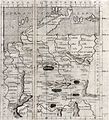
Germania Magna nach Ptolemaeus.jpg 666 × 748; 178 KB
-
Germania Magna.jpg 1,248 × 993; 998 KB
-
Imperium Romanum Germania.png 700 × 491; 203 KB
-
Map after Ptolemy's Geographia (Burney MS 111, f.28r).jpeg 5,207 × 6,832; 43.63 MB
-
P30 146 147 of 'Pomponii Melæ de situ orbis libri tres.jpg 2,230 × 2,903; 1.03 MB
-
Quarta Europae tabula (7537878198).jpg 2,000 × 1,518; 2.84 MB
-
Quarta Europe Tabula (1490).jpg 720 × 536; 279 KB
-
Quarta Europe Tabula - Rome Edition.jpg 11,936 × 9,507; 14.18 MB
-
Quarta Europe Tabula.jpg 3,231 × 2,133; 1.03 MB
-
Salzburger Residenz Toskanatrakt Kartensaal 02.jpg 2,464 × 4,008; 2.06 MB
-
Tabula Quarta dEuropa.jpg 638 × 700; 137 KB


