Category:Old maps of Trentino-South Tyrol
Jump to navigation
Jump to search
- Regions of Italy: Abruzzo · Aosta Valley · Apulia · Basilicata · Calabria · Campania · Emilia-Romagna · Friuli-Venezia Giulia · Lazio · Liguria · Lombardy · Marche · Molise · Piedmont · Sardinia · Sicily · Trentino-South Tyrol · Tuscany · Umbria · Veneto
Use the appropriate category for maps showing all or a large part of Trentino-South Tyrol. See subcategories for smaller areas:
| If the map shows | Category to use |
|---|---|
| Trentino-South Tyrol on a recently created map | Category:Maps of Trentino-South Tyrol or its subcategories |
| Trentino-South Tyrol on a map created more than 70 years ago | Category:Old maps of Trentino-South Tyrol or its subcategories |
| the history of Trentino-South Tyrol on a recently created map | Category:Maps of the history of Trentino-South Tyrol or its subcategories |
| the history of Trentino-South Tyrol on a map created more than 70 years ago | Category:Old maps of the history of Trentino-South Tyrol or its subcategories |
Subcategories
This category has the following 6 subcategories, out of 6 total.
Media in category "Old maps of Trentino-South Tyrol"
The following 56 files are in this category, out of 56 total.
-
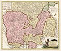
"Tyrolis comitatus" (22070560050).jpg 3,555 × 3,011; 2.62 MB
-
Territorium Tridentinum - CBT 5878363.jpg 5,658 × 4,335; 6.52 MB
-
Dominii Veneti cum vicinis Parmae, Mutinae, Mantuae et Mirandolae Statibus Nova Descriptio.jpg 7,649 × 6,531; 19.69 MB
-
1780 Bonne Map of Venice in Western Italy - Geographicus - Venice-bonne-1780.jpg 3,000 × 2,085; 1 MB
-
1799 Cary Map of Mantua, Venice and Tyrol, Italy - Geographicus - Venice-cary-1799.jpg 5,000 × 4,513; 8.31 MB
-
1801 Cary Map of Austria - Geographicus - Austria-cary-1801.jpg 5,000 × 4,488; 7.86 MB
-
Italy 1803.jpg 600 × 460; 115 KB
-
(1874) The Valleys of TIROL.jpg 2,734 × 2,108; 1.75 MB
-
(1874) MAP OF WÄLSCH-TIROL.jpg 2,702 × 2,023; 1.37 MB
-
Battisti - Il Trentino, cenni geografici, storici, economici, 1915 59.jpg 2,456 × 2,833; 2.6 MB
-
Battisti - Il Trentino, cenni geografici, storici, economici, 1915 71.jpg 2,394 × 2,855; 2.48 MB
-
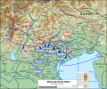
Battle of Vittorio Veneto-es.svg 1,531 × 1,273; 24.77 MB
-
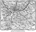
Begebenheiten im Tyrol 00033 Trient mit der Gegend auf 2 Stund.jpg 1,558 × 1,155; 1.25 MB
-
Umgebung von bozen.jpg 599 × 538; 127 KB
-
Curort Gries 1884.jpg 2,298 × 2,118; 595 KB
-
Der Oesterreichische Kreis 1806.jpg 2,503 × 1,862; 1.38 MB
-
Fronte Italiano 1915-1917.jpg 1,242 × 961; 1.06 MB
-
Giovanni Antonio Macini – Territorio di Trento.tiff 3,419 × 2,708; 26.51 MB
-
Il Tirolo con li Vescouati di Trento, e Brixen (1696).jpg 6,773 × 5,199; 10.43 MB
-
Il Trentino 177.tif 983 × 849; 3.18 MB
-
Italian Front 1915-1917.jpg 1,242 × 961; 212 KB
-
Italian Front 1915-1917.pdf 1,850 × 1,429; 1.28 MB
-
Italienska fronten 1916-17, Nordisk familjebok.png 1,197 × 698; 105 KB
-
John Cary 1799 map of the territory of Bergamo.jpg 740 × 1,353; 420 KB
-
MapOfOetztalGlaciers bySonklar 1860.jpg 800 × 726; 182 KB
-
Mappa del Trentino.jpg 2,447 × 2,859; 2.54 MB
-
Mappa galeas colori.jpg 786 × 522; 195 KB
-
Karte der Umgebung von Meran.jpg 459 × 464; 96 KB
-
Meyers b3 s0294 b1.png 606 × 527; 228 KB
-
Naunia 1829 carta geografica-thumb.jpg 7,551 × 5,361; 3.7 MB
-
Naunia 1829 carta geografica.png 7,551 × 5,361; 11.45 MB
-
Ortler Alpen Specialkarte Meurer-Freytag.jpg 12,192 × 9,712; 20.76 MB
-
Reilly 149.jpg 1,146 × 907; 451 KB
-
Southern Tyrol 1804.jpg 1,789 × 1,500; 819 KB
-
Sterzing und Franzensfeste (Tirol). NYPL1226684.tiff 5,315 × 4,432; 55.67 MB
-
Stielers Handatlas 1891 17.jpg 5,100 × 4,250; 7.39 MB
-
Trentino in Dominium Venetum in Italia, Henricus Hondius (1597-1651) BNF Gallica.jpg 1,719 × 1,577; 564 KB
-
Vallardi - Tirolo italiano.jpg 6,374 × 4,208; 13.56 MB
-
Venezia Tridentina.jpg 1,880 × 1,233; 767 KB
-
Battle of Vittorio Veneto.jpg 1,242 × 961; 221 KB
-
États Italie Trente Brixen 1702.jpg 8,576 × 5,712; 27 MB


