Category:Old maps of Africa
Jump to navigation
Jump to search
Temperate regions: North America · South America · Africa · Europe · Asia · Oceania – Polar regions: Antarctica · Arctic – Other regions: Eurasia
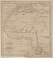
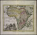
Old maps of Africa.
Use the appropriate category for maps showing all or a large part of Africa. See subcategories for smaller areas:
| If the map shows | Category to use |
|---|---|
| Africa on a recently created map | Category:Maps of Africa or its subcategories |
| Africa on a map created more than 70 years ago | Category:Old maps of Africa or its subcategories |
| the history of Africa on a recently created map | Category:Maps of the history of Africa or its subcategories |
| the history of Africa on a map created more than 70 years ago | Category:Old maps of the history of Africa or its subcategories |
Subcategories
This category has the following 33 subcategories, out of 33 total.
Media in category "Old maps of Africa"
The following 139 files are in this category, out of 139 total.
-
577 of '(With eleven maps.)' (11100142465).jpg 3,456 × 6,911; 3.7 MB
-
63 of 'Atlas' (11188132916).jpg 6,285 × 3,230; 4.53 MB
-
65 of 'Deutsche Colonialgeschichte' (11288317226).jpg 1,128 × 1,315; 251 KB
-
A naturalist in Mid-Africa BHL36984053.jpg 2,486 × 3,585; 1.73 MB
-
A naturalist in Mid-Africa BHL36984057.jpg 1,840 × 2,189; 586 KB
-
A naturalist in Mid-Africa BHL36984061.jpg 2,096 × 2,293; 714 KB
-
A new chart of the coast of ORIXA and GALCONDA NYPL1640641.tiff 7,230 × 5,428; 112.28 MB
-
Africa Map-Konkani Vishwakosh.jpg 430 × 446; 62 KB
-
Africaantiqua.jpg 3,287 × 2,051; 1.82 MB
-
Afrique connue des Anciens... - btv1b84587485.jpg 9,139 × 7,930; 9.9 MB
-
Afrique équatoriale française. LOC 2012593359.jpg 6,463 × 8,151; 6.17 MB
-
Afrique équatoriale française. LOC 2012593359.tif 6,463 × 8,151; 150.72 MB
-
AfriqueOuest1880.jpg 1,341 × 660; 140 KB
-
Age of Exploration-map.jpg 424 × 544; 40 KB
-
AMH-6328-KB Map of a stretch of the West African coast.jpg 2,400 × 1,961; 761 KB
-
Ancient africa map2.jpg 362 × 336; 51 KB
-
Arab Caliphate.jpg 888 × 674; 220 KB
-
Arab Caliphate.svg 350 × 334; 1.04 MB
-
Archives de zoologie expérimentale et générale (1909) (20138409338).jpg 3,130 × 1,950; 1.13 MB
-
Archives des missions scientifiques et littéraires (1883) (19565331858).jpg 1,916 × 2,944; 1.13 MB
-
Baedekers reseguide over Egypten, 1898 - Hallwylska museet - 100664.tif 5,616 × 3,744, 2 pages; 60.17 MB
-
Barbaria1590.jpg 800 × 600; 170 KB
-
Barbaria1598.jpg 800 × 600; 145 KB
-
Bodleian Libraries, Barbariae et Biledvlgerid, nova descriptio.jpg 1,000 × 675; 182 KB
-
Bouillet - Atlas universel, Carte 81.png 2,698 × 3,425; 6.8 MB
-
Bouillet - Atlas universel, Carte 82.png 2,695 × 1,725; 3.9 MB
-
Bouillet - Atlas universel, Carte 83.png 2,674 × 1,691; 3.9 MB
-
Bulletin - United States National Museum (1930) (19886183234).jpg 1,688 × 1,880; 630 KB
-
Carte de l'Afrique à l'échelle (...)Régnauld de btv1b59697438.jpg 1,313 × 1,053; 310 KB
-
Catalogue of a collection of birds from British East Africa BHL2643604.jpg 3,488 × 2,198; 487 KB
-
Central-Afrika nach den neuesten Forschungen bearbeitet von Dr. Joseph Chavanne. LOC 98687117.tif 9,290 × 6,416; 170.53 MB
-
Cinq Semaines en ballon 079.png 2,837 × 2,379; 1.19 MB
-
Congo-Mubangi-1908.jpg 472 × 760; 89 KB
-
Convite para a apresentação de Memória em Pedra - 2022-06-24 - Image 217850.jpg 1,582 × 1,130; 1.87 MB
-
Convite para a apresentação de Memória em Pedra - 2022-11-02 - Image 218065.jpg 1,241 × 886; 1.25 MB
-
D206- Planche VI - partie gauche - liv3-ch09.png 2,362 × 3,390; 3.85 MB
-
Die Gartenlaube (1895) 772.jpg 2,949 × 4,208; 1.68 MB
-
Dr James Johnston's thin red line across Africa 1891 to 1892.jpg 1,366 × 768; 515 KB
-
Eastern Hemisphere 1300 BC.png 3,240 × 1,903; 8.1 MB
-
Embouchure du Kongo-1747.jpg 2,048 × 2,555; 2.72 MB
-
Emin pasha relief expedition map 1890.png 1,002 × 722; 1.41 MB
-
Erdglobus aus Salem img05.jpg 4,288 × 2,848; 6.72 MB
-
Europe since 1815 (1910) (14578376507).jpg 3,072 × 1,796; 586 KB
-
Europe since 1815 (1910) (14784704053).jpg 3,184 × 1,820; 766 KB
-
Five Weeks in a Balloon.jpg 1,200 × 541; 163 KB
-
Gambia River (1732).jpg 1,200 × 824; 199 KB
-
Icones ornithopterorum (Plate III C. map) (7704027828).jpg 1,572 × 2,145; 450 KB
-
Ilemi triangle maps.JPG 668 × 558; 76 KB
-
Jansson map of West Africa c.1670.jpg 3,578 × 2,997; 5.94 MB
-
Lange diercke sachsen afrika bab el mandeb.jpg 722 × 702; 251 KB
-
Lange diercke sachsen afrika oase siwa.jpg 718 × 700; 242 KB
-
Large areas of Warri map.jpg 750 × 852; 110 KB
-
Le Tour du monde-04-p404.jpg 1,332 × 865; 294 KB
-
Le Tour du monde-05-p176.jpg 1,250 × 835; 214 KB
-
Mao Kun map - India, Africa.JPG 425 × 605; 334 KB
-
Map of Aweri (Now Warri in 1580-1700).jpg 1,242 × 2,150; 674 KB
-
Map of Awerri (Now Warri in 1580-1700).jpg 1,200 × 1,300; 501 KB
-
Map of iwere.png 800 × 500; 797 KB
-
Map of Northern Africa with a picture of African people Wellcome V0049910.jpg 4,061 × 1,813; 2.7 MB
-
Map of St. Helena, 1685.jpg 613 × 900; 430 KB
-
Map of St. Helena, 1719.jpg 851 × 1,021; 185 KB
-
Map of St. Thomas, 1683.jpg 725 × 1,078; 194 KB
-
Map of St. Thomas, 1685.jpg 639 × 900; 479 KB
-
Map of the Abyssinian empire, 1683.jpg 725 × 1,078; 156 KB
-
Map of the Abyssinian empire, 1719.jpg 858 × 1,022; 170 KB
-
Map of the Congo, 1683.jpg 725 × 1,078; 175 KB
-
Map of the Congo, 1719.jpg 851 × 1,021; 179 KB
-
Map of Tunis and Carthage, 1683.jpg 725 × 1,078; 184 KB
-
Map of Tunis and Carthage, 1719.jpg 839 × 1,022; 198 KB
-
Mapa norte de áfrica de gerardus Mercator.jpg 679 × 474; 70 KB
-
Martin Luther-Eine Heer-Predigt wider den Türcken.jpg 3,338 × 2,173; 1.82 MB
-
Mediaeval and modern history (1905) (14801328543).jpg 1,988 × 3,304; 553 KB
-
Mission de Burthe d'Annelet en Afrique française, 1928-1931 - btv1b8459033m.jpg 4,738 × 5,159; 2.53 MB
-
Nouae Africae delineatio (2675601948).jpg 2,000 × 1,872; 3.54 MB
-
Übersichtskarte der Nilländer.. (NYPL b14291191-37502).tiff 5,040 × 6,299; 90.85 MB
-
Guinea & Nigrita (NYPL b14428893-1503447).jpg 6,299 × 5,248; 7.16 MB
-
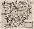
Monomotapa (NYPL b14428893-1503448) (cropped).jpg 3,436 × 2,881; 2.76 MB
-
Monomotapa (NYPL b14428893-1503448).jpg 6,299 × 5,248; 6.87 MB
-
Ottoman-map-Africa.jpg 657 × 571; 113 KB
-
Paskaart van de kust van Equatoriaal-Guinea, Gabon en Kameroen.jpeg 2,500 × 2,165; 914 KB
-
Route der Expedition der Handelshochschule.jpg 680 × 458; 223 KB
-
Révai nagy lexikona; az ismeretek enciklopédiája (1911) (14579806509).jpg 3,216 × 1,855; 1.31 MB
-
Révai nagy lexikona; az ismeretek enciklopédiája (1911) (14743444326).jpg 3,248 × 1,794; 1.31 MB
-
Southern Africa in 1860s.png 1,283 × 720; 215 KB
-
Southern African in 1850s.png 1,286 × 720; 169 KB
-
CostaAOE1896g.jpg 5,185 × 7,751; 5.32 MB
-
Südliche Oberflaeche der Erde.jpg 6,928 × 5,502; 9.33 MB
-
TabulaPeutingeriana-ModernMap.jpg 968 × 1,920; 1.93 MB
-
The American Museum journal (c1900-(1918)) (17971406538).jpg 1,238 × 1,370; 351 KB
-
The making of Northern Nigeria (1911) (14596577448).jpg 4,357 × 2,441; 1.02 MB
-
The Sea of Uniamesi - Erhardt and Rehman.png 542 × 441; 125 KB
-
UBBasel Map Afrika 1578 Kartenslg AA 114.tif 13,102 × 8,954, 2 pages; 335.66 MB
-
Van Keulen-Nieuwe Pascaert van Oost Indien-1680-1735-2.png 4,769 × 4,162; 3.48 MB
-
Verne, Jules - Cinq semaines en ballon, pages 180-181.png 2,407 × 1,959; 11.2 MB
-
Why Germany wants peace. LOC 2017585602.jpg 5,875 × 8,897; 8.69 MB
-
Why Germany wants peace. LOC 2017585602.tif 5,875 × 8,897; 149.55 MB
-
Wild game in Zambezia (1914) (14751214795).jpg 2,264 × 1,676; 501 KB
-
Sur les chevaux orientaux et provenants des races orientales. T. 3 (5596693).jpg 13,500 × 8,640; 26.97 MB
-
Sur les chevaux orientaux et provenants des races orientales. T. 3 (5596708).jpg 8,352 × 10,920; 19.33 MB


