Category:Old maps of Southern Africa
Jump to navigation
Jump to search

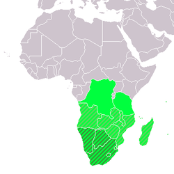
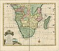
English: This category collects old maps of the southern parts of Africa in the broader sense. Depending on the map author, this wide region may even include Madagascar and the area up to the Congo. It is not to be confused with "Old maps of South Africa" (the state in more or less its modern borders).
Subcategories
This category has the following 15 subcategories, out of 15 total.
-
A
B
M
N
S
Z
Media in category "Old maps of Southern Africa"
The following 29 files are in this category, out of 29 total.
-
1455808337AnewandaccuratemapofthesouthernpartsofAfricaREDUCED.jpg 2,260 × 1,957; 1.51 MB
-
Map of Southern Africa (T. Fisher Unwin).jpg 2,492 × 2,068; 2.67 MB
-
Aethiopia Interior vel exterior - DPLA - a806aaa851d94df0ee72be3a915b385c.jpg 1,000 × 776; 235 KB
-
Africa (Southern Sheet) - DPLA - 66b808f00770a310f33b2e0d39f6b00b.jpg 1,000 × 810; 182 KB
-
Africa - DPLA - 4ef7d4a6c5214df04e5535973e0035a7 (page 1).jpg 1,000 × 919; 178 KB
-
Africa - DPLA - 7d0e5c1c7a62ca677703f5838ba99b89 (page 2).jpg 1,000 × 431; 101 KB
-
Africa Southern Sheet - DPLA - 39dcfc4f7e5458815d4b7c9d6c0719d9.jpg 1,000 × 762; 208 KB
-
Africa, South Part - DPLA - 816f4b6b854dc56d049b758695318a2d.jpg 1,000 × 712; 198 KB
-
Afrique australe anglaise Standford's Map of British south Africa - btv1b53029339b.jpg 8,732 × 7,042; 9.88 MB
-
Afrique en 3 Feuiles; Feuiille Sud - DPLA - 6917a2080475e0518e03df448ad0795c.jpg 1,000 × 830; 157 KB
-
Afrique meridionale - DPLA - 0ed7dbb796ed5d9bd9ac34e9571818b2.jpg 1,000 × 791; 173 KB
-
Afrique Meridionale - DPLA - a206aef04d7a3b0cead0baaaf52440c6.jpg 1,000 × 740; 195 KB
-
Afrique Meridionale - DPLA - ee2bddbe8197c68b06a7abc8e343bb00.jpg 1,000 × 758; 234 KB
-
Afrique Meridionale - DPLA - f27ee52f3420b3c418a897f8fb8e5536.jpg 1,000 × 771; 204 KB
-
Afrique Meridonale - DPLA - 1ea04a4ac69959aad54047be127377f8.jpg 1,000 × 767; 182 KB
-
AMH-5622-NA Map of southern Africa and Madagascar.jpg 2,400 × 1,636; 898 KB
-
Carta da Africa meridional portugueza - coordenada por A. A. d'Oliveira - btv1b53062038k.jpg 8,792 × 6,792; 10.75 MB
-
Cook's Travellers map of South Africa. 160 miles - btv1b84598994.jpg 6,096 × 7,881; 5.36 MB
-
Esboço do Mappa do Sul da Africa - DPLA - 6a4ec73fff53300665ef49379ff3bd4f.jpg 1,000 × 661; 190 KB
-
General Map of South Africa - DPLA - 442239c7b7713ad1ce99d1544ce3ba6e.jpg 1,000 × 864; 273 KB
-
Juta's Map of south Africa, from the Cape to the Zambie... (New edition) - btv1b53027855k.jpg 15,341 × 11,906; 25.52 MB
-
Meyers b9 s0487a.jpg 2,048 × 1,601; 812 KB
-
South Africa, 1834 0.tif 8,283 × 7,375, 2 pages; 349.62 MB
-
South Africa, 1834 1.jpg 4,000 × 3,383; 3.18 MB


