Category:17th-century maps of Africa
Jump to navigation
Jump to search
Temperate regions: North America · South America · Africa · Europe · Asia · Oceania – Polar regions: Antarctica · Arctic – Other regions:
Subcategories
This category has the following 50 subcategories, out of 50 total.
#
*
- Maps of Ottoman Algeria (35 F)
-
.
1
- 17th-century maps of the Red Sea (10 F)
A
- Africa - btv1b52505141j (6 F)
- 17th-century maps of Angola (10 F)
B
- 17th-century maps of Benin (6 F)
C
- 17th-century maps of Cape Verde (21 F)
D
E
G
- 17th-century maps of Ghana (2 F)
I
K
- 17th-century maps of Kenya (2 F)
L
M
N
- 17th-century maps of Namibia (2 F)
S
- 17th-century maps of Senegal (5 F)
- 17th-century maps of Somalia (3 F)
- 17th-century maps of Sudan (2 F)
T
Media in category "17th-century maps of Africa"
The following 48 files are in this category, out of 48 total.
-
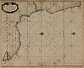
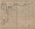 A chart of the coast of Guinea from cape de Verd to cape Bona Esperança - btv1b8595524g.jpg 8,464 × 6,990; 8.95 MB
-

-
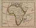
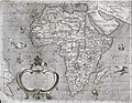
 A new mapp of Africa divided into Kingdoms and provinces... - btv1b8469383t.jpg 10,966 × 8,436; 14.22 MB
-

-

-
 Africa - Joanne Baptista Nicolosio S. T. D. sic describente - btv1b8468854h (4 of 4).jpg 8,818 × 7,008; 8.37 MB
-

-

-
 Africa1588.jpg 800 × 600; 162 KB
-
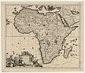
 Africae accurata tabula - btv1b84691567.jpg 9,754 × 7,344; 10.89 MB
-
 Africae accurata tabula... - btv1b84683430.jpg 9,034 × 7,224; 10.16 MB
-
 Africae accurata tabula... - btv1b84693988.jpg 9,946 × 8,364; 11.66 MB
-

-
 Africae propriae tabula in qua punica regna vites... - btv1b8469808k.jpg 8,650 × 6,456; 8.51 MB
-

-
 Afrique - btv1b8468347n.jpg 8,506 × 6,649; 10.15 MB
-
 Afrique moderne - btv1b8595155n.jpg 2,033 × 2,435; 992 KB
-
 AMH-5108-NA Map of Rio de St. Juan Damaba to Cerimgapa and a part of Madagascar.jpg 2,400 × 1,726; 295 KB
-
-
 AMH-5110-NA Map of Tamgoa to Magadoxa and the island of Pemba.jpg 2,400 × 1,705; 312 KB
-
 AMH-5111-NA Map of Brava to Moraquabier.jpg 2,400 × 1,694; 315 KB
-

-

-
-

-

-

-
 Karta över Afrika från 1688 och jordglober från 1600-talet - Skoklosters slott - 95146.tif 4,450 × 3,211; 40.9 MB
-
 L'Afrique suivant Messieurs de l'Académie Royale des Sciences - btv1b8595152d.jpg 2,808 × 2,233; 1.13 MB
-
 L'Afrique, l'une des 3 parties de nôtre continent... - btv1b8469365w.jpg 4,128 × 4,320; 2.65 MB
-
 Large-scale-old-map-of-africa-16xx.jpg 5,845 × 4,520; 8.01 MB
-
 Mao Kun map - Ceylon, Africa.png 497 × 665; 332 KB
-
 Map - Special Collections University of Amsterdam - OTM- HB-KZL 33.17.47.tif 7,296 × 6,173; 128.86 MB
-
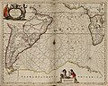
 Map of Africa by Nicolass Visscher.jpg 3,506 × 2,760; 10.05 MB
-
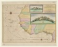
 Map of the Guinea Coast.jpg 2,462 × 1,455; 4.24 MB
-
 Mar di Æthiopia vulgo Oceanus Æthiopicus. R 2= 22. Pièce 38.jpg 8,864 × 7,088; 11.35 MB
-
 Nigritarum regnum. R 2= 22. Pièce 14bis.jpg 9,104 × 7,080; 11.89 MB
-
 Nova Africa - Hugo Allardt, excudit - btv1b8469595q.jpg 9,202 × 7,332; 11.29 MB
-
 Novissima et perfectissima Africa descriptio - btv1b53088697k.jpg 7,798 × 6,672; 10.22 MB
-
 Page 155 of Story of geographical discovery (Jacobs).png 1,518 × 1,446; 660 KB
-
-

-
 Paskaart van de cust van Portugal, Barbaria en Genehoa (2675481524).jpg 2,000 × 1,765; 3.24 MB
-
 Plan du château de la Minne en Guinée.jpg 5,184 × 3,968; 2.6 MB
-

-
 Spicchio di globo Coronelli.jpg 2,493 × 3,547; 3.16 MB
-
-


.jpg)
.jpg)


.png)


.jpg)


.jpg)