Category:Old maps showing history of Africa
Jump to navigation
Jump to search
Subcategories
This category has the following 7 subcategories, out of 7 total.
Media in category "Old maps showing history of Africa"
The following 13 files are in this category, out of 13 total.
-
Map of Africa 1914.jpg 1,311 × 1,193; 603 KB
-
500px-Mediterranean.basin.jpg 500 × 297; 55 KB
-
Africa (1909).jpg 3,347 × 4,264; 3.85 MB
-
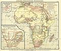
Debes 1888 Afrika.jpg 1,916 × 1,591; 3.12 MB
-
Debes 1888 Kapstaaten.jpg 745 × 754; 302 KB
-
Etat des connaissances sur lAfrique en 1876.jpg 621 × 673; 58 KB
-
Evolution map of the African countries in Haiguotuzhi.jpg 1,538 × 1,584; 737 KB
-
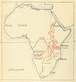
Les explorations du Sud et du Centre africains jusquen 1876.jpg 628 × 677; 45 KB
-
Map WestAfrica 16cent Blake.png 4,575 × 3,313; 1.13 MB
-
Nr. 20. Mauretanien, Numidien, Africa und Cyrenaica. Vier Karten zur Geschichte Nordafricas.png 4,171 × 3,343; 39.92 MB
-
Roman Africa.JPG 3,057 × 2,439; 1.95 MB


