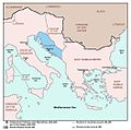
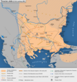
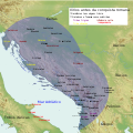
Category:Maps of the history of the ancient Balkans
Jump to navigation
Jump to search
Subcategories
This category has the following 13 subcategories, out of 13 total.
D
G
I
M
- Maps of Illyricum (65 F)
- Maps of Roman Praevalitana (18 F)
P
R
- Maps of Roman Dalmatia (32 F)
T
- Maps of ancient Thrace (84 F)
Media in category "Maps of the history of the ancient Balkans"
The following 186 files are in this category, out of 186 total.
-
Graecia Vetus Map of Ancient Greece.jpg 3,425 × 3,009; 9.28 MB
-
1865 Spruner Map of the Balkans - Geographicus - Pannonia-spruner-1865.jpg 3,500 × 2,923; 3.15 MB
-
218BCMAPMEDITERRANEAN (cropped).jpg 686 × 563; 38 KB
-
218BCMAPMEDITERRANEAN.jpg 1,216 × 720; 89 KB
-
240bcAntigonusIIGonatas.jpg 871 × 708; 236 KB
-
250bcAntigonusIIGonatas.jpg 871 × 708; 448 KB
-
67 of '(Italy and her Invaders, Vol. 1-4.)' (11216557314).jpg 2,812 × 2,268; 1.51 MB
-
A-3-37-63-Illyricum.jpg 3,000 × 2,264; 1.01 MB
-
A-3-37-64-Illyricum.jpg 3,000 × 2,273; 1.1 MB
-
Albani150ADRomanEmpire.png 677 × 455; 25 KB
-
Albanians as a migrant Dacian people.png 1,584 × 1,140; 455 KB
-
Ancient balkans 4thcentury-es.svg 2,039 × 1,823; 854 KB
-
Ancient balkans 4thcentury-sr.png 1,113 × 845; 88 KB
-
Ancient balkans 4thcentury-zh.svg 2,039 × 1,823; 318 KB
-
Ancient balkans 4thcentury.png 1,113 × 845; 88 KB
-
Ancient Epirus & Modern Borders (Colored)-pt.svg 688 × 1,002; 168 KB
-
Ancient Epirus & Modern Borders (Colored).svg 688 × 1,002; 175 KB
-
Ancient Epirus & Modern Borders zh (Colored).svg 860 × 1,252; 252 KB
-
Ancient Epirus & Modern Borders.svg 688 × 1,002; 200 KB
-
Ancient Greece Northern Part Map.jpg 2,886 × 1,978; 5.08 MB
-
Ancient Thrace under Roman rule.png 1,560 × 1,178; 685 KB
-
Aquincum-esp.jpg 704 × 541; 128 KB
-
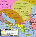
AtlBalk.a-660.jpg 318 × 327; 25 KB
-
AtlBalk.b-530.jpg 318 × 327; 29 KB
-
AtlBalk.c-430.jpg 318 × 327; 164 KB
-
AtlBalk.d-330.jpg 318 × 327; 161 KB
-
AtlBalk.e-150.jpg 318 × 327; 168 KB
-
AtlBalk0.jpg 318 × 327; 156 KB
-
AtlBalk200.jpg 318 × 327; 150 KB
-
AtlBalk400.jpg 318 × 327; 155 KB
-
Balkans 100.PNG 177 × 185; 25 KB
-
Balkans 200AD.png 436 × 313; 300 KB
-
Balkans AD125.png 495 × 261; 241 KB
-
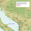
BALKANS ROMAN ROADS .jpg 1,686 × 1,239; 394 KB
-
BALKANS ROMAN ROADS cropped.jpg 1,611 × 1,074; 461 KB
-
BALKANS ROMAN ROADS.jpg 1,693 × 1,742; 994 KB
-
BalkLang-evolution.jpg 447 × 1,389; 693 KB
-
Battle of Abritus.jpg 816 × 859; 494 KB
-
Bgiusca Jirecek Line.jpg 614 × 561; 176 KB
-
BMM-BalkansInRomanTimes1.JPG 3,072 × 2,304; 1.39 MB
-
Central and Eastern Europe at the time of Augustus 6 AD.jpg 2,600 × 1,899; 740 KB
-
Colonies grecques Adriatique.png 550 × 605; 396 KB
-
Country about the Lower Danube in Roman Times.jpg 673 × 740; 141 KB
-
Culture of Antiquity.png 2,282 × 1,552; 1.28 MB
-
Dacia Aureliana - 1849.jpg 1,821 × 885; 936 KB
-
Dalmatia IcAD.png 1,606 × 1,201; 272 KB
-
Dardanija.jpg 1,600 × 1,067; 431 KB
-
Dionysius of Syracuse military expedition for Alcetas Map (English).png 994 × 793; 524 KB
-
Epirus & modern borders.jpg 410 × 600; 182 KB
-
Epirus antiquus tabula.jpg 1,000 × 954; 362 KB
-
Epirus antiquus tabula.png 1,000 × 954; 367 KB
-
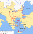
GothicInvasions 267-269-en.svg 1,030 × 1,076; 236 KB
-
GothicInvasions 267-269-es.svg 512 × 535; 305 KB
-
GothicInvasions 267-269-gl.svg 1,030 × 1,076; 242 KB
-
GothicInvasions 267-269-pt.svg 512 × 535; 104 KB
-
GothicInvasions 267-269-zh.svg 1,030 × 1,076; 233 KB
-
Gothicinvasions ukr.png 665 × 736; 212 KB
-
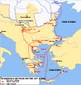
GothicInvasions250-251-ca.svg 1,030 × 1,076; 231 KB
-
GothicInvasions250-251-en.svg 1,030 × 1,076; 237 KB
-
GothicInvasions250-251-es.svg 1,030 × 1,076; 403 KB
-
GothicInvasions250-251-pt.svg 1,030 × 1,076; 237 KB
-
GothicInvasions250-251-zh.svg 1,288 × 1,345; 93 KB
-
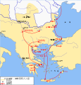
Goti 268-270 invasioni png.png 1,223 × 751; 597 KB
-
Graecia Antiqua Map of Ancient Greece 1809.jpg 800 × 542; 164 KB
-
Graecia Antiqua Map of Ancient Greece made in 1814.jpg 3,176 × 3,832; 5.44 MB
-
Grcka kolonizacija 550 st. ere.jpg 1,200 × 902; 191 KB
-
Greek colonies 550 BC (English) (simple map).svg 1,200 × 902; 873 KB
-
Greek colonies 550 BC-hu.svg 1,200 × 902; 874 KB
-
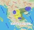
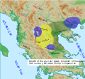
Growth of the ancient Greek Kingdom of Macedon (English) no region markers.svg 1,116 × 1,080; 1.7 MB
-
Growth of the ancient Greek Kingdom of Macedon (English).svg 1,116 × 1,080; 1.78 MB
-
Growth of the ancient Greek Kingdom of Macedon (English)v2.svg 565 × 497; 482 KB
-
Growth of the ancient Greek Kingdom of Macedon (English)v3.svg 547 × 505; 510 KB
-
Illyria and Dardania Kingdoms-sr.png 1,596 × 1,576; 118 KB
-
Illyria and Dardania Kingdoms.png 1,596 × 1,576; 118 KB
-
Illyrian Kingdom of Agron in 231 BC (Hungarian).png 1,731 × 1,015; 2.44 MB
-
Illyrian Tribes (Deutsch).svg 1,600 × 1,600; 8.57 MB
-
Illyrian Tribes (English).svg 1,600 × 1,600; 8.57 MB
-
Illyrian Tribes (Español).svg 1,600 × 1,600; 8.57 MB
-
Illyrian Tribes (Français).svg 1,600 × 1,600; 8.57 MB
-
Illyrian Tribes (Italiano).svg 1,600 × 1,600; 8.57 MB
-
Illyrian Tribes (Portuguese).svg 1,600 × 1,600; 8.57 MB
-
Illyrian Tribes (Pусский).svg 1,600 × 1,600; 8.57 MB
-
Illyrian Tribes (Shqipe).svg 1,600 × 1,600; 8.57 MB
-
Illyrian Tribes (Български).svg 1,600 × 1,600; 8.57 MB
-
Illyrian Tribes (Македонски).svg 1,600 × 1,600; 8.57 MB
-
Illyrian Tribes (Српски-srpski).svg 1,600 × 1,600; 8.57 MB
-
Illyrian Tribes es.svg 2,873 × 2,493; 15.64 MB
-
Illyrian tribes-en.png 843 × 944; 71 KB
-
Illyrian tribes-sr.png 843 × 944; 73 KB
-
Illyrians (Deutsch).svg 1,600 × 1,600; 5.11 MB
-
Illyrians (English).svg 1,600 × 1,600; 5.11 MB
-
Illyrians (Español).svg 1,600 × 1,600; 5.11 MB
-
Illyrians (Français).svg 1,600 × 1,600; 5.11 MB
-
Illyrians (Hungarian).svg 1,600 × 1,600; 5.11 MB
-
Illyrians (Italiano).svg 1,600 × 1,600; 5.11 MB
-
Illyrians (Portuguese).svg 1,600 × 1,600; 5.11 MB
-
Illyrians (Pусский).svg 1,600 × 1,600; 5.11 MB
-
Illyrians (Shqipe).svg 1,600 × 1,600; 5.11 MB
-
Illyrians (Български).svg 1,600 × 1,600; 5.11 MB
-
Illyrians (Македонски).svg 1,600 × 1,600; 5.11 MB
-
Illyrians (Српски-srpski).svg 1,600 × 1,600; 5.11 MB
-
Illyrians proper.png 970 × 913; 893 KB
-
IllyricumAD6RomanConditionofTribes.png 1,836 × 1,533; 2.56 MB
-
Illyrii Proprie Dicti aka Illyrians Proper aka Docleatae-pt.svg 716 × 507; 684 KB
-
Illyrii Proprie Dicti aka Illyrians Proper aka Docleatae.svg 716 × 507; 697 KB
-
Influences-Balkans.png 642 × 561; 603 KB
-
Invasione 249-251.png 1,223 × 751; 454 KB
-
KingdomofTeuta.png 2,000 × 2,000; 3.95 MB
-
Komotini Via espanol.JPG 733 × 600; 82 KB
-
Language influence border between Latin and Hellenic.png 3,763 × 2,557; 4.49 MB
-
Macedonia-Thracia-Illyria-Moesia-Dacia1849.jpg 2,038 × 1,677; 1.12 MB
-
Macedonia-Thracia-Illyria-Moesia-Dacia1849refurbished.jpg 2,038 × 1,677; 837 KB
-
Map of Bardyli’s dynasty at its peak.png 758 × 713; 164 KB
-
Map of the ancient Greek Kingdom of Macedon (with settlements) (English).svg 1,453 × 960; 2.55 MB
-
Map of the ancient Greek Kingdom of Macedon (without settlements) (English).svg 1,453 × 960; 2.48 MB
-
Map of the Kingdom of Agron of the Ardiaei (English).png 2,000 × 2,000; 3.95 MB
-
Map of the Kingdom of Agron of the Ardiaei (English).svg 1,600 × 1,600; 6.46 MB
-
Map of the Kingdom of Agron of the Ardiaei (Portuguese).svg 1,600 × 1,600; 6.46 MB
-
Map of the Kingdom of Gentius in 169 BC (Hungarian).png 1,731 × 1,015; 2.39 MB
-
Map of the Kingdom of Gentius of the Ardiaei (English).svg 1,600 × 1,600; 6.39 MB
-
Map of the Kingdom of Gentius of the Ardiaei (Portuguese).svg 1,600 × 1,600; 6.39 MB
-
Map of the Kingdom of Pinnes in 228 BC (Hungarian).png 1,731 × 1,015; 2.5 MB
-
Map of the Kingdom of Teuta of the Ardiaei (English).svg 1,600 × 1,600; 6.46 MB
-
Map of the Kingdom of Teuta of the Ardiaei (Portuguese).svg 1,600 × 1,600; 6.46 MB
-
Map of the Paeonian Tribes (English).svg 1,621 × 1,186; 2.49 MB
-
Map of the Paeonian Tribes (Portuguese).svg 1,621 × 1,186; 2.49 MB
-
Map of the Paeonian Tribes-es.svg 413 × 320; 4.57 MB
-
Map of the territory of Demetrius of Pharos (English).png 2,000 × 2,000; 3.95 MB
-
Map of the territory of Demetrius of Pharos (English).svg 1,600 × 1,600; 6.43 MB
-
Map of the territory of Demetrius of Pharos (Portuguese).svg 1,600 × 1,600; 6.43 MB
-
Map of Triballi tribe (English).jpg 558 × 396; 123 KB
-
Map of Triballi tribe-es.svg 559 × 395; 200 KB
-
Marcellinus Dalmatia-it.svg 822 × 750; 118 KB
-
Marcellinus Dalmatia.jpg 1,054 × 1,041; 98 KB
-
Mediterranean at 218 BC-de.png 2,858 × 1,696; 453 KB
-
Mediterranean at 218 BC-en.svg 2,058 × 1,221; 435 KB
-
Mediterranean at 218 BC-es.svg 2,058 × 1,221; 1.04 MB
-
Mediterranean at 218 BC-fr.svg 2,058 × 1,221; 457 KB
-
Mediterranean at 218 BC-he.svg 512 × 304; 368 KB
-
Mediterranean at 218 BC-mk.svg 2,058 × 1,221; 907 KB
-
Mediterranean at 218 BC-pt.svg 2,058 × 1,221; 659 KB
-
Mediterranean at 218 BC-zh.svg 2,572 × 1,526; 493 KB
-
Origins 300BC.png 498 × 407; 321 KB
-
PAEONIAN ARDIAEAN (ILLYRIAN) DARDANIAN KINGDOMS EXTENT DURING 230 BC.png 1,049 × 938; 1.88 MB
-
Pannonia moesia dacia illyricum.jpg 1,600 × 1,085; 559 KB
-
PieriaPieresExpulsionMap.jpg 600 × 558; 219 KB
-
PieriaPieresExpulsionMapb.jpg 605 × 494; 293 KB
-
Post Roman Balkans.jpg 2,038 × 1,677; 721 KB
-
Praetorian Prefectures of the Roman Empire 395 AD-ar.png 900 × 595; 161 KB
-
Praetorian Prefectures of the Roman Empire 395 AD.png 900 × 595; 144 KB
-
Praevalis 4 c AD.svg 1,052 × 744; 186 KB
-
Praevalis 4c AD map.svg 1,600 × 1,200; 183 KB
-
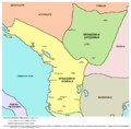
Praevalis or Praevalitana in Illyricum 306 cAD.svg 744 × 1,052; 22 KB
-
Praevalitana 4c AD 2.svg 1,024 × 768; 183 KB
-
Praevalitana in the Roman Emp.jpg 1,177 × 881; 98 KB
-
Praevalitana in The Roman Empire.jpg 1,064 × 801; 89 KB
-
Praevalitana or Praevalis in Ilyricum 306 c AD a2.svg 1,052 × 744; 127 KB
-
Prefecture of Illyricum map-sr.png 1,054 × 1,041; 92 KB
-
Prefecture of Illyricum map-zh.png 1,054 × 1,041; 101 KB
-
Prefecture of Illyricum map.png 1,054 × 1,041; 103 KB
-
PrefectureIllyricum.png 1,054 × 1,041; 96 KB
-
Reforme Konstantina I i Praevalitana, 321 godine.svg 680 × 974; 31 KB
-
Rivolta pannonica 6 jpg.JPG 1,127 × 777; 241 KB
-
Rivolta pannonica 7.jpg 1,127 × 777; 242 KB
-
Rivolta pannonica 8.jpg 1,127 × 777; 239 KB
-
Rivolta pannonica 9.jpg 1,127 × 777; 244 KB
-
Roman Dardania part of Moesia Superior part of old map made 1865.jpg 1,148 × 1,012; 1.3 MB
-
Roman Empire Map AlexanderFindlay1849.png 2,038 × 1,828; 2 MB
-
Roman provinces in a 1867 school atlas.jpg 3,717 × 2,866; 969 KB
-
Roman provinces of Illyricum, Macedonia, Dacia, Moesia, Pannonia and Thracia.jpg 2,817 × 2,284; 1.41 MB
-
Southeast Europe in the 450s AD.png 491 × 407; 340 KB
-
The boundary of the Western and Eastern Roman Empire on the Adriatic Sea.svg 744 × 1,052; 270 KB
-
Theoretical map of Romanian origins.png 972 × 751; 705 KB
-
Thraciae-veteris-typvs.jpg 4,452 × 3,424; 3.59 MB
-
Tracian state.png 1,386 × 1,481; 926 KB
-
Tribalia diagrama.jpg 2,038 × 1,677; 2 MB
-
Tribes in Illyria (English).svg 1,600 × 1,600; 5.17 MB
-
Tribes in Illyria (Greek).svg 1,600 × 1,600; 5.18 MB
-
Tribes in Illyria (Portuguese).svg 1,600 × 1,600; 5.17 MB
-
Tribes in Illyria (Pусский).svg 1,600 × 1,600; 5.18 MB


