Category:Maps of the European Antiquity
Jump to navigation
Jump to search
Subcategories
This category has the following 8 subcategories, out of 8 total.
Pages in category "Maps of the European Antiquity"
This category contains only the following page.
Media in category "Maps of the European Antiquity"
The following 87 files are in this category, out of 87 total.
-
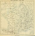
10. Carte de distribution des anses en oméga.jpg 1,886 × 1,158; 1.06 MB
-
Albaniaoldmap.jpg 648 × 337; 42 KB
-
Ancient colonies-ar.png 2,500 × 1,249; 982 KB
-
Ancient colonies.PNG 2,500 × 1,249; 761 KB
-
Bunbury Vol 1 Map 01 Ulysses p 84.jpg 1,970 × 3,337; 405 KB
-
Bunbury Vol 1 Map 02 Hecataeus p 148.jpg 2,801 × 3,017; 618 KB
-
Bunbury Vol 1 Map 03 Herodotus p172.jpg 3,271 × 2,053; 439 KB
-
Bunbury Vol 1 Map 04 Scythia Herodotus p 206.jpg 2,813 × 2,630; 457 KB
-
Bunbury Vol 1 Map 05 Hanno p 330.jpg 1,970 × 3,337; 629 KB
-
Bunbury Vol 1 Map 06 Xenophon Alexander p 358.jpg 3,271 × 2,091; 1.05 MB
-
Bunbury Vol 1 Map 07 Cunaxa p 372.jpg 2,661 × 3,152; 474 KB
-
Bunbury Vol 1 Map 08 Alexander Asia p 464.jpg 3,248 × 1,648; 740 KB
-
Bunbury Vol 1 Map 09 Alexander India.jpg 3,136 × 4,751; 1.48 MB
-
Bunbury Vol 2 Map 01 Caesar p 130.jpg 2,435 × 2,493; 1.19 MB
-
Bunbury Vol 2 Map 02 Romans Germany p 194.jpg 2,650 × 1,717; 369 KB
-
Bunbury Vol 2 Map 03 Strabo p 238.jpg 2,949 × 1,640; 410 KB
-
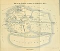
Bunbury Vol 2 Map 04 Pomponius Mela p 368.jpg 2,715 × 2,308; 787 KB
-
Bunbury Vol 2 Map 05 Roman Empire p 442.jpg 3,363 × 2,390; 890 KB
-
Bunbury Vol 2 Map 06 Erythrean Sea p 476.jpg 2,506 × 1,671; 316 KB
-
Bunbury Vol 2 Map 07 Dionysius Periegetes p 490.jpg 2,668 × 2,145; 715 KB
-
Bunbury Vol 2 Map 08 Ptolemy p 578.jpg 3,401 × 2,183; 829 KB
-
Bunbury Vol 2 Map 09 Ptolemy Britain p 584.jpg 2,689 × 2,277; 764 KB
-
Bunbury Vol 2 Map 10 Africa Ptolemy p 632.jpg 2,437 × 1,702; 309 KB
-
Codanus sinus.PNG 271 × 231; 18 KB
-
Crossing of the Rhine map.jpg 5,476 × 3,310; 7.07 MB
-
Culture of Antiquity.png 2,282 × 1,552; 1.28 MB
-
Democratic Ideals and Reality, 1919 Fig 5 p52-3.jpg 3,393 × 1,562; 484 KB
-
Democratic Ideals and Reality, 1919 Fig 6 p 56.jpg 1,323 × 1,326; 171 KB
-
Empire of Attila.png 1,333 × 841; 644 KB
-
Europa400AD.JPG 750 × 469; 64 KB
-
Europa60AD.jpeg 750 × 469; 72 KB
-
Europe at the fall of the Western Roman Empire in 476.jpg 5,491 × 3,506; 4.35 MB
-
Europe in the Migration Period in the 4th and 5th centuries.jpg 5,476 × 3,310; 4.33 MB
-
Europe map 220BC fr.png 1,143 × 1,091; 71 KB
-
Europe map 220BC.PNG 1,143 × 1,091; 77 KB
-
Gallia, Britannia, Germania, Provinciae Danuvienses, Heinrich Kiepert (1903).jpg 7,133 × 5,622; 8.43 MB
-
Gaule -56 cropped.PNG 660 × 448; 152 KB
-
Germany(with autonomous Slovakia) & Hungary 1938.jpg 3,000 × 2,267; 2.38 MB
-
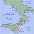
Great Greece ka.png 591 × 591; 172 KB
-
Great Greece.jpg 591 × 591; 221 KB
-
Greek Colonization Archaic Period-es.svg 10,012 × 5,437; 872 KB
-
Greek Colonization Archaic Period.png 684 × 388; 42 KB
-
Greek Colonization Archaic Period.svg 855 × 485; 433 KB
-
Homer's Ithaka-Dorpf-01.jpg 363 × 559; 31 KB
-
Map of Syracuse RU.png 800 × 1,651; 108 KB
-
Mediterranea world200bc-es.svg 1,428 × 313; 76 KB
-
Mediterranean Basin and Near East before 1000 AD locator map.svg 3,000 × 1,856; 435 KB
-
Mediterranean Basin and Near East before 1000 AD topographic map.jpg 3,000 × 1,856; 2.23 MB
-
Northern provinces of the Roman Empire in the middle of the 2nd century.jpg 2,048 × 1,673; 742 KB
-
Near East480ad.jpg 1,402 × 1,023; 226 KB
-
NorthSea395AD.jpg 684 × 775; 368 KB
-
Odoacer 480ad.jpg 900 × 545; 701 KB
-
OldestCitiesContinuouslyInhabitedInEuropeToPresentDay.svg 1,356 × 1,171; 1.46 MB
-
Origins 200 AD.png 769 × 665; 297 KB
-
Parthia and Rome century2bc-es.svg 1,428 × 313; 46 KB
-
Parthia and Rome century2bc-pt.svg 512 × 121; 26 KB
-
PhoenicianTrade EN.svg 2,000 × 1,000; 368 KB
-
PhoenicianTrade es.svg 2,000 × 1,000; 436 KB
-
PhoenicianTrade ZH.svg 2,500 × 1,250; 157 KB
-
Ptolemaic-Empire 200bc.jpg 1,164 × 636; 1.02 MB
-
Ptolemaic-Empire 200bcARABIC.JPG 800 × 437; 119 KB
-
Roman Empire 125 general map-zh.png 2,732 × 2,271; 6.07 MB
-
Roman Empire 125 political map-de.svg 2,186 × 1,817; 6.32 MB
-
Roman Empire 125 political map-zh.png 2,049 × 1,703; 2.99 MB
-
Roman Empire 125 political map-zh.svg 2,732 × 2,271; 2.02 MB
-
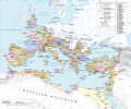
Roman Empire 125 political map.png 2,186 × 1,817; 3.21 MB
-
Roman Empire 125 political map.svg 2,186 × 1,817; 3.25 MB
-
Roman Empire 125.png 2,186 × 1,817; 4.43 MB
-
Roman-Empire 200bc.jpg 1,164 × 636; 887 KB
-
Romana Res Publica (provinciae).PNG 732 × 442; 21 KB
-
Rome-Seleucia-Parthia 200bc.jpg 1,205 × 567; 767 KB
-
Rome476.jpg 750 × 469; 79 KB
-
Römische Geschichte gekürzte Ausgabe - page 978.jpg 1,352 × 2,201; 1.72 MB
-
Sarmatia Antiqua (2).jpg 1,210 × 953; 696 KB
-
Sarmatia Antiqua.jpg 1,536 × 1,268; 477 KB
-
The Western Mediterranean, 800-600 B.C., H. G. Wells' Outline of History, page 209.jpg 1,652 × 1,170; 256 KB
-
Volsci.jpg 572 × 380; 240 KB
-
Weighing equipment1.png 1,386 × 1,514; 1.49 MB
-
West Mediterranean Areas 279 BC.png 1,340 × 937; 2.07 MB
-
West Mediterranean Areas 306 BC.png 1,340 × 937; 2.06 MB
-
West Mediterranean Areas 348 BC.png 1,340 × 937; 2.32 MB
-
Western Europe 5th Century ang.svg 700 × 575; 2.3 MB
-
Western Europe 5th Century en.svg 700 × 575; 2.3 MB


