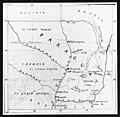
Category:Maps of the history of Paraguay
Jump to navigation
Jump to search
Subcategories
This category has the following 6 subcategories, out of 6 total.
M
O
T
W
Media in category "Maps of the history of Paraguay"
The following 27 files are in this category, out of 27 total.
-
Aceval-Tamayo, 1887.png 1,464 × 1,652; 264 KB
-
Benítez-Ichazo border treaty 1894.png 1,464 × 1,652; 267 KB
-
Benítez-Ichazo, 1894.png 1,464 × 1,652; 267 KB
-
Brasil - Colonizacion vèrs 1690.png 1,131 × 1,271; 247 KB
-
Brasil - Periòde coloniau vèrs 1790.png 1,117 × 1,270; 254 KB
-
Cosme.jpg 2,648 × 2,580; 1.22 MB
-
Decoud-Quijano, 1879.png 1,464 × 1,652; 263 KB
-
Estabelecimento novo.jpg 2,394 × 1,600; 991 KB
-
Mapa ARGENTINA 1840 expedicion de lavalle.png 400 × 504; 82 KB
-
Mapa Virreinato Rio de la Plata2.png 250 × 334; 17 KB
-
Matemapa.JPG 297 × 296; 16 KB
-
Misiones en 1752.jpg 770 × 777; 443 KB
-
Misiones-paraguayy.jpg 400 × 444; 34 KB
-
ORIENTALES.png 4,634 × 4,537; 1.49 MB
-
Paraguai - Evolucion territòriala.png 948 × 753; 146 KB
-
Pinilla-Soler, 1907.png 1,464 × 1,960; 284 KB
-
Provincias Unidas de Sud América -1816.png 286 × 532; 49 KB
-
Provincias unidas de sudamerica.png 244 × 416; 39 KB
-
Reducciones-he.png 568 × 371; 30 KB
-
Reducciones.PNG 593 × 429; 24 KB
-
Reducciones.svg 568 × 390; 387 KB
-
Reducciones2.svg 394 × 338; 132 KB
-
Reivindicó Bolivia.png 1,612 × 1,960; 292 KB
-
Reivindicó Paraguay.png 1,612 × 1,960; 291 KB
-
Republica del Guayra.jpg 1,034 × 744; 92 KB
-
Réductions jésuites.png 594 × 420; 27 KB
-
Virreinato.png 310 × 599; 46 KB


