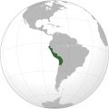
Category:Maps of the history of Peru
Jump to navigation
Jump to search
Subcategories
This category has the following 8 subcategories, out of 8 total.
C
M
O
S
T
W
Pages in category "Maps of the history of Peru"
This category contains only the following page.
Media in category "Maps of the history of Peru"
The following 14 files are in this category, out of 14 total.
-
Ayamarca kingdom.png 954 × 1,117; 181 KB
-
Confederación de Bracamoros.png 1,980 × 1,117; 393 KB
-
Cusco con S.jpg 2,560 × 1,920; 2.2 MB
-
Estado Neoincaico.svg 486 × 601; 44 KB
-
Etnias-Ancash.svg 512 × 706; 456 KB
-
Gonzalo Pizarro sailing in Peru.JPG 868 × 1,119; 321 KB
-
Gran Colombia-Campañas del sur.png 550 × 550; 83 KB
-
Pacific Culture Areas-de incl. Queensland and Peru.png 1,271 × 778; 306 KB
-
Peruvian Crisis.png 500 × 500; 44 KB
-
Preincas.svg 722 × 722; 204 KB
-
RealFelipe1825.jpg 1,699 × 1,215; 1.33 MB


