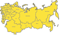
Category:Maps of the Soviet Union
Jump to navigation
Jump to search
Austrian Empire · Austria-Hungary · Great Britain · British Empire · Byzantine Empire · Carolingian Empire · Fatimid Caliphate · Republic of Genoa · Habsburg Monarchy · Holy Roman Empire · Polish-Lithuanian Commonwealth · Ottoman Empire · Papal States · Prussia · Grand Duchy of Moscow · Spanish Netherlands · Tsardom of Russia · Russian Empire · Soviet Union · Spanish Empire · Republic of Venice ·
- Maps of the former Soviet Union — and its constituent Republics, Autonomous Republics, Oblasts, et al.
Subcategories
This category has the following 28 subcategories, out of 28 total.
Pages in category "Maps of the Soviet Union"
This category contains only the following page.
Media in category "Maps of the Soviet Union"
The following 96 files are in this category, out of 96 total.
-
 1991 Errusiar Federazioaren barne-banaketa.jpg 1,529 × 1,331; 601 KB
-
 800px-Soviet Union.PNG 800 × 548; 61 KB
-
 A map of USSR (22089878895).jpg 5,640 × 4,000; 10.28 MB
-
 Blank Map of Soviet Union (1922-1991).png 671 × 462; 7 KB
-
 Carte-secretno.jpg 1,500 × 993; 239 KB
-
 CDC members.png 334 × 266; 9 KB
-
 Central and Eastern Siberia - DPLA - 4a74bd395fb10a6db21f093a73f27aef.jpg 11,952 × 8,211; 5.56 MB
-
 Central and Eastern Siberia - DPLA - 613d29816cab69964785c9df3fbbb40d.jpg 11,933 × 8,203; 5.47 MB
-
 Central and Eastern Siberia - DPLA - 8b7fbae3fcc414f36e300ad55608e623.jpg 11,934 × 8,211; 5.52 MB
-

-
 Chuprynka plan.png 800 × 547; 171 KB
-
 Communist Party HQ Paris 286-MP-par-04275.jpg 4,528 × 3,732; 1.56 MB
-
 Economic Regions, (USSR)- Southern Region - DPLA - 54a2b176ac085df0c28774437eb8df3a.jpg 12,030 × 8,211; 7.69 MB
-
 EurasecMap (1).png 1,356 × 928; 66 KB
-

-
 Russia Fortepan 9528.jpg 3,335 × 2,007; 3.29 MB
-
 Fotothek df roe-neg 0006484 004 Einführungslektion mit Herrn Colditz.jpg 800 × 536; 147 KB
-
 General map of smolensk region.png 486 × 454; 30 KB
-
 Geography.png 2,549 × 1,822; 3.24 MB
-
 GKChP in the regions August 20 1991.svg 600 × 371; 821 KB
-
 ICAO-airport-codes-U-original.jpg 2,000 × 1,237; 966 KB
-
 INF-Related Facilities (Western Soviet Union) - DPLA - c7ebd39e6bbb3bcb8764c854c30dd4ad.jpg 2,550 × 3,274; 5.52 MB
-
 Karte Entkulakisierung.png 1,287 × 804; 218 KB
-
-
 Map of Soviet regions.svg 2,341 × 1,332; 501 KB
-
-
 Märjamaa asundus NSVL-i topograafilisel kaardil (1967).png 1,536 × 695; 1.57 MB
-
 Nikolayev zone 1923.png 837 × 464; 329 KB
-
 Operational Navigation Chart E-10, 5th edition.jpg 9,254 × 6,658; 13.13 MB
-
 Operational Navigation Chart E-11, 4th edition.jpg 9,254 × 6,772; 8.08 MB
-
 Operational Navigation Chart E-4, 2nd edition.jpg 9,254 × 6,729; 20.31 MB
-
 Operational Navigation Chart E-5, 4th edition.jpg 9,254 × 6,684; 16.86 MB
-
 Operational Navigation Chart E-6, 7th edition.jpg 9,254 × 6,742; 18.3 MB
-
 Operational Navigation Chart E-7, 5th edition.jpg 9,254 × 6,657; 22.26 MB
-
 Operational Navigation Chart E-8, 6th edition.jpg 8,066 × 5,841; 17.05 MB
-
 Operational Navigation Chart F-4, 7th edition.jpg 9,254 × 6,681; 18.57 MB
-
 Operational Navigation Chart F-5, 6th edition.jpg 9,254 × 6,742; 19.02 MB
-
 Partiment Germanosovietic d'Euròpa Orientala.png 905 × 622; 141 KB
-
 Regions of the Soviet Union.png 2,341 × 1,332; 175 KB
-
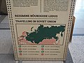 Reisimine Nõukogude Liidus.jpg 4,608 × 3,456; 7.67 MB
-
 Reproductiecamera, Bestanddeelnr 254-5201.jpg 2,658 × 2,641; 720 KB
-
 Republics of the Soviet Union - DPLA - 44ea85f4e785ac4a200473c2a4b62c47.jpg 2,552 × 3,278; 2.14 MB
-
 South Yemen Soviet Union locator map.png 940 × 477; 152 KB
-
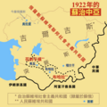 Soviet Central Asia 1922 zh.png 2,000 × 2,000; 517 KB
-
 Soviet Fire.png 1,356 × 928; 204 KB
-
 Soviet involvement in regime change.svg 2,754 × 1,398; 880 KB
-
 Soviet Union flag map with subdivisions.png 1,389 × 1,021; 91 KB
-
 Soviet Union location map (1930).svg 600 × 371; 1.07 MB
-
 Soviet-tarybu-padomju-noukogude-radziecki.png 2,000 × 2,000; 623 KB
-
 Sovjet Union vs. NATO in the cold war (1975).png 1,107 × 903; 264 KB
-
 Sovyet Bölgelerinde Mal Tedarik Öncelikleri.jpg 3,786 × 2,270; 923 KB
-
 Sowjet Russland 1922.png 536 × 179; 22 KB
-
 Territorial extent of the Union of Soviet Socialist Republics (1922-1940).png 2,560 × 1,626; 1.05 MB
-
 Territorial extent of the Union of Soviet Socialist Republics (1944-1991).png 2,560 × 1,699; 946 KB
-
 The first proposals for the division of Japan - WW2.png 4,470 × 3,510; 724 KB
-
 The Soviet Union and all of its states.png 6,460 × 3,403; 1,005 KB
-
 Txu-oclc-6614368-nl52-12.jpg 5,000 × 3,821; 6.08 MB
-
 Txu-oclc-6614368-nl52-3.jpg 5,000 × 3,828; 4.43 MB
-
 Txu-oclc-6614368-nl52-9.jpg 5,000 × 3,818; 5.26 MB
-
 Txu-oclc-6614368-nl53-1.jpg 5,000 × 3,797; 4.59 MB
-
 Txu-oclc-6614368-nl53-2.jpg 5,000 × 3,790; 4.68 MB
-
 Txu-oclc-6614368-nl53-4.jpg 5,000 × 3,794; 5.4 MB
-
 Txu-oclc-6614368-nl53-7-2nd-ed.jpg 5,000 × 3,846; 4.86 MB
-
 Txu-oclc-6614368-nm50-3.jpg 5,000 × 3,812; 4.11 MB
-
 Txu-oclc-6614368-nm50-6.jpg 5,000 × 3,847; 3.87 MB
-
 Txu-oclc-6614368-nm50-8.jpg 5,000 × 3,888; 3.77 MB
-
 Txu-oclc-6614368-nm50-9.jpg 5,000 × 3,783; 3.43 MB
-
 Txu-oclc-6614368-nm51-1.jpg 5,000 × 3,804; 3.91 MB
-
 Txu-oclc-6614368-nm52-1.jpg 5,000 × 3,841; 4.34 MB
-
 Txu-oclc-6614368-nm52-11.jpg 5,000 × 3,793; 3.92 MB
-
 Txu-oclc-6614368-nm52-12.jpg 5,000 × 3,774; 4.69 MB
-
 Txu-oclc-6614368-nm52-4.jpg 5,000 × 3,772; 4.43 MB
-
 Txu-oclc-6614368-nm52-7.jpg 5,000 × 3,792; 4.76 MB
-
 Txu-oclc-6614368-nm52-8.jpg 5,000 × 3,750; 4.13 MB
-
 Txu-oclc-6614368-nm53-10.jpg 5,000 × 3,854; 4.85 MB
-
 Txu-oclc-6614368-nn51-10.jpg 5,000 × 3,821; 4.67 MB
-
 Txu-oclc-6614368-nn51-12.jpg 5,000 × 3,791; 4.66 MB
-
 Txu-oclc-6614368-nn51-7.jpg 5,000 × 3,790; 4.62 MB
-
 Txu-oclc-6614368-nn51-8.jpg 5,000 × 3,819; 4.58 MB
-
 Txu-oclc-6614368-nn52-10.jpg 5,000 × 3,800; 4.21 MB
-
 Txu-oclc-6614383-nk52-6.jpg 5,000 × 3,677; 5 MB
-

-
 Union of Socialist Republics - DPLA - 8d6f26b1b4a5301f71fe0d81b624558e (page 1).jpg 15,300 × 10,971; 16.58 MB
-
 Union of Socialist Republics - DPLA - 8d6f26b1b4a5301f71fe0d81b624558e (page 2).jpg 15,248 × 10,695; 16.92 MB
-

-

-

-
-
 Untitled Map of the U.S.S.R. - DPLA - b855ed35913413e8d05fa42026cc1a64.jpg 3,272 × 2,550; 1.91 MB
-
 Vakhan (Wakhan) Corridor.jpg 1,671 × 864; 346 KB
-
 War Comes To School- Life at Peckham Central School, London, England, 1943 D12190.jpg 1,243 × 1,300; 331 KB
-
 Численность "спецпоселенцев"-калмыков по субъектам СССР на 1 января 1953 г.png 2,448 × 1,558; 535 KB
-
 Численность "спецпоселенцев"-крымских татар по субъектам СССР на 1 января 1953 г.png 2,448 × 1,558; 575 KB
-
 Численность "спецпоселенцев"-турок-месхетинцев по субъектам СССР на 1 января 1953 г.png 2,448 × 1,558; 541 KB
-
 רוסיה- דצמבר 1919-ינואר 1920.png 1,024 × 548; 189 KB
-
 نەخشەی کوردستانی سوور.png 3,264 × 2,479; 759 KB


.jpg)


-_Southern_Region_-_DPLA_-_54a2b176ac085df0c28774437eb8df3a.jpg)
.png)


_-_DPLA_-_c7ebd39e6bbb3bcb8764c854c30dd4ad.jpg)


.png)


.svg)

.png)

.png)
.png)


_-_DPLA_-_3f8c578cb0d82f16e26f5cadbb9b1410.jpg)
.jpg)
.jpg)
_Administrative_Divisions_1946_-_DPLA_-_00c2e042d8d01734e76c1bda3dbdd278.jpg)
_Administrative_Divisions_1946_-_DPLA_-_55ac899d975b61069872d3a0b468de81.jpg)
_Administrative_Divisions_1946_-_DPLA_-_64bddb6b155e7464d0ee8382fdf14c6e.jpg)
-_Forest_Distribution_-_DPLA_-_5a53c4fc37345cbc3b0f810cfcdac00d.jpg)

_Corridor.jpg)


.png)