Category:Maps of the history of Murmansk Oblast
Jump to navigation
Jump to search
Federal subjects of the Russian Federation:
Republics: Adygea · Bashkortostan · Buryatia · Chechnya · Chuvashia · (Crimea) · Dagestan · Ingushetia · Kabardino-Balkaria · Kalmykia · Karachay–Cherkessia · Karelia · Mari El · Mordovia · North Ossetia — Alania · Tatarstan · UdmurtiaKrais: Krasnoyarsk · Primorsky ·
Oblasts: Arkhangelsk · Belgorod · Bryansk · Kursk · Leningrad · Moscow · Murmansk · Oryol · Pskov · Smolensk · Tver · Voronezh ·
Federal cities: Moscow · Saint Petersburg ·
Autonomous oblast:
Autonomous okrugs:
Subcategories
This category has the following 2 subcategories, out of 2 total.
E
K
- Maps of Kolsky Uyezd (8 F)
Media in category "Maps of the history of Murmansk Oblast"
The following 31 files are in this category, out of 31 total.
-
RAE(1875) Map of Russian Lapland.jpg 4,083 × 3,007; 5.63 MB
-
1928 atlas of the Soviet Union (Murmansk Oblast).jpg 1,206 × 1,078; 590 KB
-
ApproxPositionsWWI-1919 hu.png 641 × 800; 498 KB
-
ApproxPositionsWWI-1919.png 717 × 895; 629 KB
-
Corelia on Gerritsz map.jpg 2,417 × 2,121; 2.7 MB
-
KAL Flight 902's flightplan.png 1,083 × 1,436; 391 KB
-
Kitchen-03-Russian-Lapland-2877.jpg 2,560 × 1,920; 2.03 MB
-
Kitchen-21-Russian-Lapland-2801.jpg 2,560 × 1,920; 2.05 MB
-
Kol'skiy pivosrtiv XVI 01.jpg 1,679 × 1,249; 289 KB
-
Kola and nearest land, XVI centuary.gif 762 × 500; 346 KB
-
Mogilnoje.jpg 1,000 × 810; 212 KB
-
Moscovia Delisle Guillaume 1706.jpg 5,413 × 3,999; 5.39 MB
-
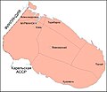
Murmanskij okrug-1931.jpg 536 × 463; 24 KB
-
North Scandinavia 1544.jpg 1,020 × 820; 281 KB
-
Norway-Russia 1825.jpg 1,200 × 865; 67 KB
-
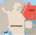
Pechenga 1920.svg 666 × 656; 252 KB
-
Ptolemeus mapa Europe Kol's'kiy pivostriv.jpg 526 × 600; 75 KB
-
RussiaMurmansk2005.png 300 × 178; 34 KB
-
RussiaMurmansk2007-01.png 300 × 178; 44 KB
-
RussiaMurmansk2007-07.png 300 × 178; 40 KB
-
Russian-Lapland-1745.jpg 2,127 × 1,860; 599 KB
-
Septentrionales.jpg 1,904 × 1,370; 334 KB
-
Tabularussiae.jpg 807 × 621; 304 KB
-
Екатерининская гавань и город Александровск.jpg 999 × 1,251; 270 KB
-
Карта Кольского полуострова от Кандалакши до плотины Нива.jpg 2,550 × 3,484; 1.14 MB
-
Карта Мурманской железной дороги. 1926 г. Российская государственная библиотека.jpg 5,268 × 8,268; 5.6 MB
-
Кильдин на карте 1682 года.jpg 1,122 × 588; 100 KB
-
Кильдин на карте 1790 года.jpg 1,000 × 741; 85 KB
-
Ленинградская и Мурманская области и Карело-Финской ССР.jpg 1,624 × 2,316; 4.38 MB


