Category:Maps of the East of England
Jump to navigation
Jump to search
Subcategories
This category has the following 11 subcategories, out of 11 total.
B
C
E
F
H
N
O
S
Media in category "Maps of the East of England"
The following 43 files are in this category, out of 43 total.
-
165 of 'About England- or, First lessons in English Geography' (11124827394).jpg 870 × 1,120; 251 KB
-
2024 UK general election results East of England.svg 898 × 810; 612 KB
-
AA EastEngla.jpg 1,033 × 867; 326 KB
-
East England in England.png 814 × 953; 107 KB
-
East of England constituencies 2011 map.svg 1,210 × 1,266; 2.35 MB
-
East of England counties 2009 map.svg 1,210 × 1,266; 2.2 MB
-
East of England counties 2019 map.jpg 5,042 × 5,275; 873 KB
-
East of England counties 2019 map.svg 1,210 × 1,266; 2.26 MB
-
East of England Counties.png 1,593 × 1,440; 1.06 MB
-
East of England districts 2011 map.svg 1,210 × 1,266; 2.14 MB
-
East of England districts 2019 map.svg 470 × 492; 5.79 MB
-
East of England in England.svg 816 × 991; 996 KB
-
East of England map.png 2,971 × 2,597; 1.21 MB
-
East of England map.svg 1,464 × 1,112; 434 KB
-
East of England wards 2011 map coloured.svg 1,210 × 1,266; 5.99 MB
-
East of England wards 2011 map.svg 1,210 × 1,266; 6.01 MB
-
East of England wards 2012 map.svg 1,210 × 1,266; 6.01 MB
-
EastAnglia.png 524 × 636; 253 KB
-
Eastengla rice on Pendan ylde.svg 645 × 645; 313 KB
-
ENG-East-bedford.png 360 × 400; 50 KB
-
ENG-East-cambridge.png 360 × 400; 50 KB
-
ENG-East-essex.png 360 × 400; 50 KB
-
ENG-East-hertford.png 360 × 400; 50 KB
-
ENG-East-norfolk.png 360 × 400; 50 KB
-
ENG-East-suffolk.png 360 × 400; 50 KB
-
England Region - East England.svg 525 × 650; 83 KB
-
England south of the humber and east of the isle of wight.png 164 × 240; 4 KB
-
EnglandEastEngland.png 200 × 247; 15 KB
-
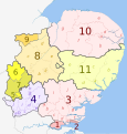
EnglandEastNumbered.png 200 × 205; 20 KB
-
Home Counties (1889 county borders).svg 430 × 345; 63 KB
-
Lowestoft College Map.jpg 180 × 176; 33 KB
-
Lowestoft College Map3.jpg 216 × 211; 21 KB
-
NUTS 3 regions of the East of England 2010 map.svg 1,210 × 1,266; 2.17 MB
-
NUTS 3 regions of the East of England 2015 map.svg 1,210 × 1,266; 2.34 MB
-
NUTS 3 regions of the East of England map.svg 1,210 × 1,266; 2.17 MB
-
Ostanglien.png 400 × 493; 120 KB
-
Province of Westminster.png 556 × 559; 20 KB
-
The kingdom of East Anglia (Early Saxon period) PL.svg 647 × 649; 497 KB
-
The kingdom of East Anglia (Early Saxon period)-es.svg 647 × 649; 442 KB
-
The kingdom of East Anglia (Early Saxon period)-fr.svg 647 × 649; 235 KB
-
The kingdom of East Anglia (Early Saxon period).svg 647 × 649; 511 KB
-
United Kingdom AV referendum East of England results.svg 1,210 × 1,266; 2.14 MB
-
United Kingdom General Election 2017 Results Map (East of England).svg 719 × 947; 794 KB


