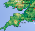
Category:Maps of South West England
Jump to navigation
Jump to search
Wikimedia category | |||||
| Upload media | |||||
| Instance of | |||||
|---|---|---|---|---|---|
| Category combines topics | |||||
| South West England | |||||
one of nine official regions of England, United Kingdom | |||||
| Instance of | |||||
| Location | England | ||||
| Capital | |||||
| Population |
| ||||
| Area |
| ||||
| official website | |||||
 | |||||
Subcategories
This category has the following 11 subcategories, out of 11 total.
B
C
D
G
O
S
W
Media in category "Maps of South West England"
The following 37 files are in this category, out of 37 total.
-
A group of noble dames--map of Wessex.png 3,063 × 1,965; 191 KB
-
Avon and Somerset UK PCC election 2024.svg 814 × 697; 597 KB
-
Bridgy1.jpeg 417 × 378; 76 KB
-
Bristolcut1.png 465 × 412; 289 KB
-
Cornubian batholith.png 1,471 × 881; 480 KB
-
Cornubian Batholith.svg 1,390 × 738; 72 KB
-
EB1911 - England and Wales, section VI.jpg 850 × 601; 153 KB
-
England Region - South West.svg 525 × 650; 83 KB
-
EnglandSouthWest.png 200 × 247; 6 KB
-
EnglandSouthWestNumbered.png 400 × 290; 35 KB
-
EnglandSouthWestRegion2004.png 200 × 247; 12 KB
-
EnglishSouthMidlandsCountiesMap.png 625 × 569; 27 KB
-
Map of south-west England shown within England (Met Office region).png 2,400 × 2,736; 152 KB
-
Map of south-west England shown within England (Met Office region).svg 2,400 × 2,736; 70 KB
-
NUTS 3 regions of South West England map.svg 1,425 × 1,118; 1.81 MB
-
South West England by Anonymous101.svg 512 × 632; 9 KB
-
South West England constituencies 2011 map.svg 1,425 × 1,118; 2.11 MB
-
South West England counties 2009 map.svg 1,425 × 1,118; 1.83 MB
-
South West England counties 2023 map.svg 1,425 × 1,118; 1.72 MB
-
South West England counties.png 1,281 × 936; 258 KB
-
South West England districts 2011 map.svg 1,425 × 1,118; 1.84 MB
-
South West England in England.png 814 × 953; 107 KB
-
South West England in England.svg 816 × 991; 996 KB
-
South West England parish 2011 map.svg 1,425 × 1,118; 6.93 MB
-
South West England Rugby Union location map.svg 1,354 × 996; 1.76 MB
-
South West England wards 2011 map.svg 1,425 × 1,118; 5.14 MB
-
South West England wards 2012 map.svg 1,425 × 1,118; 5.13 MB
-
South West England, Kurdish population (2011).svg 1,425 × 1,118; 1.84 MB
-
SouthWest-local-government-2019.jpg 5,938 × 4,658; 773 KB
-
SW England +county names.png 1,912 × 1,496; 508 KB
-
Topographic map of south-west England (labeled).png 535 × 360; 476 KB
-
Topographic map of south-west England.png 535 × 360; 466 KB
-
United Kingdom AV referendum South West England results.svg 1,425 × 1,118; 1.84 MB
-
West country england.png 386 × 312; 13 KB
-
West of England Combined Authority map (within South West England).svg 1,425 × 1,118; 1.81 MB
-
Westcountrymap.png 501 × 375; 16 KB


