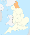
Category:Maps of North East England
Jump to navigation
Jump to search
Wikimedia category | |||||
| Upload media | |||||
| Instance of | |||||
|---|---|---|---|---|---|
| Category combines topics | |||||
| North East England | |||||
region of England | |||||
| Instance of | |||||
| Location | England | ||||
| Capital | |||||
| Population |
| ||||
| Area |
| ||||
 | |||||
Subcategories
This category has the following 8 subcategories, out of 8 total.
D
N
O
T
Media in category "Maps of North East England"
The following 26 files are in this category, out of 26 total.
-
England locator map with North East England highlighted.svg 816 × 991; 469 KB
-
England Region - North East.svg 525 × 650; 83 KB
-
EnglandNorthEast.png 200 × 247; 15 KB
-
EnglandNorthEastNumbered.png 200 × 264; 19 KB
-
Map of Northern England.png 1,479 × 1,080; 301 KB
-
North east coalfield and rivers.jpg 1,223 × 1,743; 556 KB
-
North East Combined Authority among combined authorities in England map, 2021.svg 1,152 × 1,152; 9.05 MB
-
North East Combined Authority UK map.svg 1,082 × 1,345; 697 KB
-
North East England constituencies 2011 map.svg 1,082 × 1,345; 970 KB
-
North East England counties 2.2.png 842 × 1,100; 70 KB
-
North East England counties 2009 map.svg 1,082 × 1,345; 723 KB
-
North East England districts 2011 map.svg 1,082 × 1,345; 697 KB
-
North East England in England.png 814 × 953; 107 KB
-
North East England in England.svg 816 × 991; 996 KB
-
North East England wards 2011 map coloured.svg 1,082 × 1,345; 2.15 MB
-
North East England wards 2011 map.svg 1,082 × 1,345; 2.14 MB
-
North East England wards 2012 map.svg 1,082 × 1,345; 2.14 MB
-
North East Mayor Local Authorities.svg 1,082 × 1,345; 710 KB
-
Northern England within the UK.png 1,821 × 3,089; 754 KB
-
Northern England.svg 816 × 991; 594 KB
-
NPennines.jpg 1,261 × 709; 84 KB
-
NUTS 3 regions of North East England map.svg 1,082 × 1,345; 714 KB
-
Ordnance Survey Quarter-inch sheet 11 North Midlands and Yorkshire, published 1964.jpg 9,601 × 8,904; 10.65 MB
-
School, Pit Village, Beamish Museum, 12 April 2008 (1).jpg 2,592 × 3,888; 4.04 MB
-
Souter Lighthouse, General Plan (11110162384).jpg 2,272 × 1,291; 388 KB
-
United Kingdom AV referendum North East England results.svg 1,082 × 1,345; 697 KB


