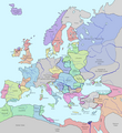
Category:Maps showing history of the Middle Ages
Jump to navigation
Jump to search
Purpose: Group Maps together by Historical era in categories used by the commons. This category cross references all maps covering the historical era, old or new.
Historical epoch
[edit]The purpose of this category is to provide narrower grouping of events, personages, and places into their more specific traditional third division of the overall Middle Ages. Some entities will necessarily span more than one of these categories.
Roughly spans the years: 500 AD—1520 AD; (From the fall of Rome to the nascent Protestant Reformation when Martin Luther nails his 95 theses to the door.)
See also
[edit]- Category:Early Middle Ages— 500–1000 AD; 5th to 10th Centuries
Wikimedia category | |||||
| Upload media | |||||
| Instance of | |||||
|---|---|---|---|---|---|
| |||||
- Category:High Middle Ages — 1000–1300 AD; 11th, 12th, 13th Centuries
- Category:Late Middle Ages — 1301–1500 AD; 14th, 15th Centuries
- Category:Old maps of Europe
Subcategories
This category has the following 11 subcategories, out of 11 total.
Pages in category "Maps showing history of the Middle Ages"
This category contains only the following page.
Media in category "Maps showing history of the Middle Ages"
The following 28 files are in this category, out of 28 total.
-
34 of 'The History of Norway. (With maps.)' (11184806384).jpg 2,256 × 2,953; 1.06 MB
-
A magyarok vandorlasa.jpg 1,248 × 1,074; 248 KB
-
Carte Perche.jpg 1,524 × 1,202; 688 KB
-
Central Europe, 919-1125.jpg 2,281 × 1,801; 1,013 KB
-
Coliseo medieval.jpg 1,299 × 899; 1.16 MB
-
Contado de Volterra 1.png 1,602 × 1,378; 328 KB
-
Diffusion de la peste noire en europe 1347-1351.png 1,280 × 1,387; 134 KB
-
Europa en el año 1000.png 1,051 × 748; 1.38 MB
-
Europe in 1328 (cropped).png 508 × 330; 6 KB
-
Europe in 1328 112619.png 2,150 × 2,337; 208 KB
-
Europe in 1328-ko.svg 1,075 × 1,168; 160 KB
-
Europe in 1328.png 2,150 × 2,336; 761 KB
-
Europe in 900 AD.png 2,830 × 2,480; 1.56 MB
-
Europe Moyen-âge.jpg 3,543 × 2,577; 2.25 MB
-
Europe, 814.jpg 2,280 × 1,812; 673 KB
-
Franconia 919-1125.jpg 446 × 391; 137 KB
-
FürstentumRügen.png 515 × 534; 26 KB
-
Hereford Mapa Mundi.jpg 351 × 396; 88 KB
-
Itinerari dei mercanti lombardi e genovesi nel Medioevo.svg 430 × 656; 556 KB
-
Mediaeval and modern history (1905) (14594439949).jpg 1,904 × 2,954; 631 KB
-
Mediaeval and modern history (1905) (14594597857).jpg 2,092 × 3,006; 890 KB
-
Mediaeval and modern history (1905) (14758100406).jpg 2,002 × 1,452; 431 KB
-
Medieval Open Field System.JPG 1,363 × 1,755; 1.35 MB
-
Medieval-World-Religions.png 2,159 × 1,781; 2.42 MB
-
Plan mediaeval manor.jpg 1,458 × 2,154; 1.84 MB
-
Premieresvillesecossaises.png 639 × 880; 53 KB
-
The French Loire campaign of 1429-ru.svg 1,800 × 1,600; 5.98 MB
-
Van Loon Mediæval Trade.jpg 4,104 × 3,008; 4.19 MB


