Category:Maps of medieval Africa
Jump to navigation
Jump to search
Subcategories
This category has the following 14 subcategories, out of 14 total.
*
Media in category "Maps of medieval Africa"
The following 14 files are in this category, out of 14 total.
-
Conquests of Amda Seyon.png 1,280 × 905; 96 KB
-
Ethiopia 1400.svg 1,052 × 744; 3.55 MB
-
Ethiopian Empire in 1952.svg 1,052 × 744; 275 KB
-
Map of ancient and Medieval Sub-Saharan states zoomed in.jpg 658 × 519; 131 KB
-
Map of ancient and Medieval Sub-Saharan states.jpg 1,172 × 1,197; 876 KB
-
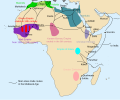
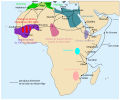
Medieval Arab Slave Trade.svg 13,834 × 11,508; 154 KB
-
Medieval Ethiopia (1270 - 1524).png 853 × 621; 23 KB
-
Medieval Ethiopia Extent.png 514 × 514; 65 KB
-
Medieval ethiopia map on world sphere.svg 550 × 550; 135 KB
-
Medieval Ethiopia map.svg 1,521 × 1,435; 1.13 MB
-
Mereb Melash.png 17,877 × 20,000; 4.22 MB
-
Traite musulmane medievale (corr).svg 799 × 663; 147 KB
-
Traite musulmane medievale-es.svg 799 × 663; 358 KB
-
Traite musulmane medievale.svg 799 × 663; 146 KB


