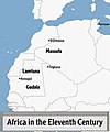
Category:Maps of Africa in the 11th century
Jump to navigation
Jump to search
English: This category is about history maps that show the history of Africa between 1001-1100 CE, i.e. in the 11th century.
Do not confuse: Contemporary old maps belong into: Category:Old maps of Africa and its subcategories.
Do not confuse: Contemporary old maps belong into: Category:Old maps of Africa and its subcategories.
Maps of the history of Africa: (BCE) 5th century · (CE) 3rd century · 5th century · 6th century · 8th century · 9th century · 10th century · 11th century · 12th century · 13th century · 14th century · 15th century · 16th century · 17th century · 18th century · 19th century · 20th century ·
Subcategories
This category has the following 5 subcategories, out of 5 total.
M
- Maps of Almoravid dynasty (48 F)
- Maps of the Ghana Empire (19 F)
- Maps of the Hammadid dynasty (40 F)
- Maps of the Ifranids (9 F)
- Maps of the Zirid dynasty (48 F)
Media in category "Maps of Africa in the 11th century"
The following 7 files are in this category, out of 7 total.
-
Carte des Hammadides et leurs voisins v.1050.png 5,284 × 2,674; 1.42 MB
-
Repartition maghrawas.jpg 828 × 410; 68 KB
-
Sanhaja tribes 11th century.jpg 1,125 × 1,353; 344 KB
-
Scission des lignées zirides, Hammadides-Badicides-Zawides.PNG 596 × 430; 16 KB
-
Zirides et Hammadides.PNG 603 × 393; 16 KB
-
ZiríesYHamadíes-pt.svg 628 × 401; 111 KB
-
ZiríesYHamadíes.svg 628 × 401; 112 KB


