Category:Maps of Africa in the 15th century
Jump to navigation
Jump to search
English: This category is about history maps that show the history of Africa between 1401-1500 CE, i.e. in the 16th century.
Do not confuse: Contemporary old maps belong into: Category:15th-century maps of Africa and its subcategories.
Do not confuse: Contemporary old maps belong into: Category:15th-century maps of Africa and its subcategories.
Maps of the history of Africa: (BCE) 5th century · (CE) 3rd century · 5th century · 6th century · 8th century · 9th century · 10th century · 11th century · 12th century · 13th century · 14th century · 15th century · 16th century · 17th century · 18th century · 19th century · 20th century ·
Subcategories
This category has the following 4 subcategories, out of 4 total.
M
- Maps of the Hafsid dynasty (19 F)
- Maps of the Marinid dynasty (23 F)
- Maps of the Zayyanid dynasty (26 F)
Media in category "Maps of Africa in the 15th century"
The following 13 files are in this category, out of 13 total.
-
Africa Portuguese Empire 1342-1801.png 1,525 × 1,440; 3.53 MB
-
Bartolomeu Dias Voyage hi.png 933 × 1,162; 1,006 KB
-
Caminho maritimo para a India.png 556 × 396; 39 KB
-
Chewa.png 850 × 850; 275 KB
-
Cidades-estado da costa suaíle.png 1,003 × 1,003; 325 KB
-
Ethiopia 1500.svg 1,052 × 744; 3.53 MB
-
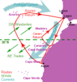
Henrican navigation routes.gif 294 × 311; 19 KB
-
Map of the Jolof Empire.png 2,706 × 2,031; 947 KB
-
Medieval Ethiopia Extent.png 514 × 514; 65 KB
-
Mereb Melash.png 17,877 × 20,000; 4.22 MB
-
Treaty of Granada, 1447.png 1,920 × 1,080; 257 KB
-
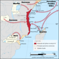
Vasco de Gama map-fr.svg 1,087 × 1,124; 887 KB
-
ممتلكات البرتغال بشمال أفريقيا.jpg 2,440 × 2,011; 975 KB


