Category:Maps of Iława
Jump to navigation
Jump to search
Wikimedia category | |||||
| Upload media | |||||
| Instance of | |||||
|---|---|---|---|---|---|
| Category combines topics | |||||
| Iława | |||||
town and administrative center of Iława district in Warmian-Masurian Voivodeship of northeastern Poland | |||||
| Instance of |
| ||||
| Location | Iława County, Warmian-Masurian Voivodeship, Poland | ||||
| Inception |
| ||||
| Population |
| ||||
| Area |
| ||||
| Different from | |||||
| official website | |||||
 | |||||
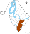
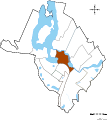
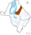
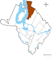
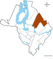
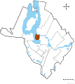
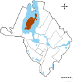
W tej kategorii znajdują się mapy dotyczące Iławy.
Media in category "Maps of Iława"
The following 39 files are in this category, out of 39 total.
-
30lat.svg 1,000 × 1,000; 18 KB
-
Blank map IŁAWA-miasta partnerskie.svg 1,200 × 1,000; 390 KB
-
Centrum ilawy.svg 3,182 × 3,622; 738 KB
-
Dzielnica Przemysłowa osiedle w Iławie.svg 1,472 × 1,646; 304 KB
-
Frednowy-Ilawa.png 477 × 523; 391 KB
-
Ilawa Location (Mapa).PNG 580 × 425; 54 KB
-
Image-Jezioro Mały Jeziorak w Iławie3.svg 1,430 × 1,113; 1.01 MB
-
Iława location map.svg 1,001 × 1,166; 758 KB
-
Iława mapa.svg 3,125 × 2,027; 343 KB
-
Jezioro Mały Jeziorak w Iławie2.svg 1,432 × 1,111; 1,013 KB
-
Legenda do mapy Iławy.svg 3,172 × 1,621; 397 KB
-
Centrum osiedle w Iławie.svg 1,472 × 1,646; 304 KB
-
Dąbrowskiego osiedle w Iławie.svg 1,472 × 1,646; 304 KB
-
Gajerek osiedle w Iławie.svg 1,472 × 1,646; 304 KB
-
Kopernika osiedle w Iławie.svg 1,472 × 1,646; 304 KB
-
Lipowy Dwór osiedle w Iławie.svg 1,472 × 1,646; 304 KB
-
Lubawskie osiedle w Iławie.svg 1,472 × 1,646; 304 KB
-
Ostródzkie osiedle w Iławie.svg 1,472 × 1,646; 304 KB
-
Piastowskie osiedle w Iławie.svg 1,472 × 1,646; 304 KB
-
Podleśne w Iławie.svg 1,472 × 1,646; 304 KB
-
Sienkiewicza osiedle w Iławie.svg 1,472 × 1,646; 304 KB
-
Stare Miasto osiedle w Iławie.svg 1,472 × 1,646; 304 KB
-
Słoneczne osiedle w Iławie.svg 1,472 × 1,646; 304 KB
-
Wielka Żuława osiedle w Iławie.svg 1,472 × 1,646; 304 KB
-
Wojska Polskiego osiedle w Iławie.svg 1,472 × 1,646; 304 KB
-
XXX-Lecia osedle w Iławie.svg 1,472 × 1,646; 304 KB
-
Mapa Zieleni w Iławie.svg 1,452 × 1,646; 725 KB
-
Mapkailawy.png 2,046 × 1,380; 709 KB
-
Osiedla w Iławie.svg 1,472 × 1,646; 1.04 MB
-
Osiedla.svg 1,000 × 1,000; 18 KB
-
Plan Iławy z 1753 roku.PNG 1,645 × 1,247; 3.59 MB
-
Plan Iławy z 1810 roku.PNG 1,748 × 1,249; 2.92 MB
-
POL Iława map.svg 497 × 463; 47 KB
-
Poprawka mapy stare miasto w iławie.svg 21,817 × 14,693; 734 KB
-
Poprawka mapy stare miasto w iławie1.svg 21,817 × 14,693; 800 KB
-
Sienkiewicza.svg 1,000 × 1,000; 18 KB
-
Stare miasto w Iławie.svg 21,817 × 14,693; 743 KB
-
Staremiastoiława.svg 1,000 × 1,000; 18 KB
-
Tansport w Ilawie MAPA.svg 1,452 × 1,646; 826 KB


