Category:Maps of borders of Canada
Jump to navigation
Jump to search
Countries of the Americas: Argentina · Barbados · Belize · Bolivia · Brazil · Canada · Chile · Colombia · Costa Rica · Dominican Republic · Ecuador · El Salvador · Guatemala · Guyana · Haiti · Honduras · Jamaica · Mexico · Nicaragua · Panama · Paraguay · Peru · Suriname · Trinidad and Tobago · United States of America · Uruguay · Venezuela
Subcategories
This category has the following 4 subcategories, out of 4 total.
Media in category "Maps of borders of Canada"
The following 34 files are in this category, out of 34 total.
-
180 of 'The History of Canada' (11195602836).jpg 2,432 × 1,535; 780 KB
-
1903 Alaska boundary dispute.png 538 × 538; 16 KB
-
1926 Canada-Alaska 1903 boundary-map.jpg 448 × 432; 55 KB
-
1926 Canada-Alaska 1903 boundary-map.png 429 × 418; 433 KB
-
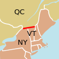
45th parallel US Canada.svg 250 × 250; 32 KB
-
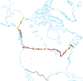
49th parallel US Canada border.svg 650 × 350; 48 KB
-
Alaska boundary dispute.jpg 1,184 × 1,096; 438 KB
-
C. 1782 - The two lines of frontier agreed to by Oswald.jpg 1,887 × 1,136; 1.02 MB
-
Canada disputed w1 countrymap.svg 1,000 × 1,000; 152 KB
-
Carte Canada & pays limitrophes 1850.jpg 2,062 × 808; 353 KB
-
Disputed Border in the East.jpg 3,813 × 3,072; 3.21 MB
-
Elm Point.png 600 × 400; 419 KB
-
Great Lakes and St. Lawrence Seaway map 1959.png 2,627 × 1,583; 3.63 MB
-
Height of Land Portage.png 1,235 × 830; 154 KB
-
ISS044-E-4651 - View of Earth.jpg 4,928 × 3,280; 3.54 MB
-
MNMap-doton-International Falls.png 262 × 300; 10 KB
-
Nares strait border (Kennedy channel).png 1,765 × 1,249; 124 KB
-
Northwest-Angle,-MN.png 428 × 355; 17 KB
-
NorthwesternPointLakeoftheWoods.svg 372 × 524; 15 KB
-
Oregoncountry.png 1,000 × 1,019; 1.25 MB
-
Pointrobertswide oli 2020210 lrg.jpg 2,695 × 1,797; 5.68 MB
-
Pointrobertswide oli 2020210.jpg 720 × 480; 508 KB
-
Pointrobertszm oli 2020210.jpg 720 × 600; 368 KB
-
RG77-CWMF-W52-BoundCommRoute.JPG 727 × 2,331; 378 KB
-
The Exploration and Survey of the 141st Meridian Alaska Nelles 1913 Map.jpg 6,491 × 5,424; 8.02 MB
-
ThousandIslands2022OSM.png 6,018 × 4,243; 12.13 MB
-
US-Canada border counties.png 1,513 × 983; 179 KB
-
US-Canada-Border-Provinces.svg 429 × 420; 380 KB
-
US-Canada-Border-States.svg 429 × 420; 384 KB
-
USA-Border-States.svg 688 × 279; 8.72 MB
-
USBP Interior Checkpoints FY2020.png 2,249 × 1,782; 946 KB
-
Webster-Ashburton treaty map-en.svg 730 × 583; 109 KB
-
Webster-Ashburton treaty map-es.svg 730 × 583; 112 KB
-
Webster-Ashburton treaty map-fr.svg 730 × 588; 204 KB


