Category:Maps of borders of Peru
Jump to navigation
Jump to search
Subcategories
This category has the following 7 subcategories, out of 7 total.
C
E
M
P
Media in category "Maps of borders of Peru"
The following 7 files are in this category, out of 7 total.
-
 Complejo Chacalluta.png 850 × 1,100; 54 KB
-
 Dominio de facto de las tres republicas en el Acre.png 4,504 × 2,760; 269 KB
-
 Dominio Marítimo del Perú.svg 1,168 × 1,513; 187 KB
-
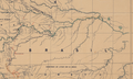 Frontera entre el Perú y Brasil (1906).png 1,439 × 869; 2.18 MB
-
 Hazell's annual a cyclopædic record of men and topics of the day (1905) (14775597324).jpg 4,304 × 2,488; 1.27 MB
-
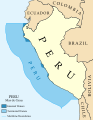 Maritime Claims of Peru.svg 1,168 × 1,513; 181 KB
-
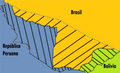
 Negociaciones entre Perú-Bolivia y Brasil-Bolivia por la amazonia.jpg 580 × 521; 199 KB


.png)
_(14775597324).jpg)

