Category:Maps of borders of Brazil
Jump to navigation
Jump to search
Subcategories
This category has the following 4 subcategories, out of 4 total.
Media in category "Maps of borders of Brazil"
The following 19 files are in this category, out of 19 total.
-
Argentina-Brazil border.png 999 × 1,343; 183 KB
-
B-C-E-P claims and reivindications.jpg 373 × 261; 53 KB
-
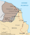
Border-Brazil-France-es.svg 494 × 575; 213 KB
-
Border-Brazil-France.svg 494 × 575; 26 KB
-
BR-Albers-Mercator.svg 512 × 512; 57 KB
-
Brazil contested territores before 1900.jpg 516 × 620; 92 KB
-
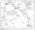
Brazil-Uruguay border.png 1,204 × 1,032; 165 KB
-
Dominio de facto de las tres republicas en el Acre.png 4,504 × 2,760; 269 KB
-
Frontera Paraguaya - boliviana.jpg 3,509 × 2,481; 1.19 MB
-
Grenzverlauf F-BRA.png 3,223 × 2,701; 11.47 MB
-
Hazell's annual a cyclopædic record of men and topics of the day (1905) (14775597324).jpg 4,304 × 2,488; 1.27 MB
-
Mapa da Tríplice Fronteira (Argentina, Brasil e Paraguai).png 2,176 × 2,172; 273 KB
-
Mapa del Punto Tripartito Bolivia Brasil Paraguay.png 852 × 685; 99 KB
-
Mapa questão do Pirara-es.svg 583 × 645; 199 KB
-
Mapa questão do Pirara.svg 583 × 645; 199 KB
-
Negociaciones entre Perú-Bolivia y Brasil-Bolivia por la amazonia.jpg 580 × 521; 199 KB
-
Punto Tripartito (Bolivia-Perú-Brasil).svg 1,209 × 845; 89 KB
-
Questão da fronteira.PNG 544 × 599; 51 KB
-
TRATADO DE MONTEVIDÉU DE 1890.jpg 813 × 514; 152 KB


