Category:Maps of borders of Suriname
Jump to navigation
Jump to search
Media in category "Maps of borders of Suriname"
The following 11 files are in this category, out of 11 total.
-
Disputed Areas Venezuela-Guyana-Suriname-FrenchGuiana.svg 842 × 595; 227 KB
-
Disputed Territories Venezuela Guyana Suriname Fr Guiana.png 8,420 × 5,950; 1.2 MB
-
Grenzverlauf F-SME.png 3,601 × 3,337; 16.55 MB
-
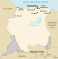
Kaart van Suriname met betwiste Gebieden.png 5,802 × 5,950; 858 KB
-
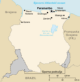
Karta Surinama.png 5,802 × 5,950; 866 KB
-
Map of Surname including disputed areas.png 5,802 × 5,950; 857 KB
-
Mapa Surinamu.png 5,802 × 5,950; 858 KB
-
Official borders of the Republic of Suriname 2.png 2,800 × 1,700; 456 KB
-
Official borders of the Republic of Suriname.png 3,280 × 2,168; 573 KB
-
Suriname - Guyana Disputed Area - Camp Tigri Occupied Since 1969.jpg 2,127 × 1,954; 1.27 MB
-
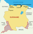
Suriname Disputed Areas Marked.png 2,270 × 2,322; 443 KB


