Category:Old maps of Queensland
Jump to navigation
Jump to search
Subcategories
This category has the following 4 subcategories, out of 4 total.
Media in category "Old maps of Queensland"
The following 15 files are in this category, out of 15 total.
-

-
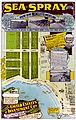 Sea Spray at Woody Point Estate Map.jpg 3,806 × 6,000; 6.41 MB
-
 StateLibQld 2 202459 Plan of Sefton Estate, Clayfield, Brisbane.jpg 1,000 × 675; 142 KB
-

-

-
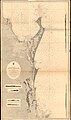 Admiralty Chart No 1068 Moreton Bay to Sandy Cape, Published 1870.jpg 11,079 × 18,802; 71.04 MB
-
 Admiralty Chart No 2354 Cape Grenville to Booby Island, Published 1855, New Edition 1915.jpg 19,382 × 10,896; 55.46 MB
-
 Admiralty Chart No 2920 Cape Direction to Cape Grenville, Published 1897.jpg 10,865 × 16,159; 58.06 MB
-
 Admiralty Chart No 2921 Claremont Point to Cape Direction, Published 1899.jpg 14,627 × 16,185; 69.49 MB
-
 Admiralty Chart No 2922 Turtle Group to Claremont Point, Published 1891.jpg 20,779 × 10,908; 71.67 MB
-
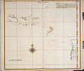
 Carte d'une Partie de la Côte de la Nle. Galles Meridle. (18951780623).jpg 5,112 × 4,264; 3.14 MB
-

-

-
 StateLibQld 1 263100.jpg 1,000 × 845; 132 KB
-
 Watson map tribes of south east Queensland.jpg 3,598 × 5,471; 940 KB
..._-_btv1b53074850v_(5_of_5).jpg)


.jpg)


.jpg)


%27_(11200587595).jpg)