Category:Maps of Qom Province
Jump to navigation
Jump to search
- Provinces of Iran
- Alborz
- Ardabil
- Bushehr
- Chaharmahal and Bakhtiari
- East Azerbaijan
- Fars
- Gilan
- Golestan
- Hamadan
- Hormozgan
- Ilam
- Isfahan
- Kerman
- Kermanshah
- Khuzestan
- Kohgiluyeh and Boyer-Ahmad
- Kurdistan
- Lorestan
- Markazi
- Mazandaran
- North Khorasan
- Qazvin
- Qom
- Razavi Khorasan
- Semnan
- Sistan and Baluchestan
- South Khorasan
- Tehran
- West Azerbaijan
- Yazd
- Zanjan
Media in category "Maps of Qom Province"
The following 21 files are in this category, out of 21 total.
-
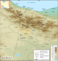
Carte Topo Region Teheran.png 2,176 × 2,300; 3.89 MB
-
Fatima Masumeh Shrine comparing map.gif 2,200 × 2,475; 441 KB
-
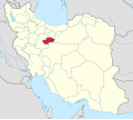
IRAN-OSTAN-QOM.PNG 2,385 × 2,124; 306 KB
-
IranQom.svg 1,200 × 1,071; 470 KB
-
NI 39-6 Qom, Iran.jpg 5,000 × 3,858; 3.98 MB
-
NI 39-7 Aran, Iran.jpg 5,000 × 3,746; 3.34 MB
-
Qom Blank map.png 2,156 × 2,316; 53 KB
-
Qom counties fa.svg 960 × 660; 47 KB
-
Qom counties.svg 960 × 660; 52 KB
-
Qom Metro map-Future-geo.png 2,156 × 2,316; 62 KB
-
Qom Metro map-Plan-geo.png 2,156 × 2,316; 50 KB
-
Qom Province Ethnic Map.png 965 × 527; 21 KB
-
Qom-admin-map.PNG 1,009 × 712; 44 KB
-
Qom-map-notext.PNG 1,009 × 712; 40 KB
-
Qum ostanı bəxşləri.jpg 2,748 × 2,418; 306 KB
-
Txu-oclc-58750648-ni39-3.jpg 5,000 × 3,891; 3.39 MB
-
بارندگی استان قم.png 1,448 × 1,076; 97 KB
-
راههای استان قم.png 1,448 × 1,076; 165 KB
-
رودهای استان قم.png 1,448 × 1,076; 136 KB
-
صنعت و معدن استان قم.png 1,448 × 1,327; 134 KB
-
مسیرهای دسترسی به سد کبار.jpg 704 × 516; 29 KB


