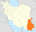
Category:Maps of Sistan and Baluchestan Province
Jump to navigation
Jump to search
- Provinces of Iran
- Alborz
- Ardabil
- Bushehr
- Chaharmahal and Bakhtiari
- East Azerbaijan
- Fars
- Gilan
- Golestan
- Hamadan
- Hormozgan
- Ilam
- Isfahan
- Kerman
- Kermanshah
- Khuzestan
- Kohgiluyeh and Boyer-Ahmad
- Kurdistan
- Lorestan
- Markazi
- Mazandaran
- North Khorasan
- Qazvin
- Qom
- Razavi Khorasan
- Semnan
- Sistan and Baluchestan
- South Khorasan
- Tehran
- West Azerbaijan
- Yazd
- Zanjan
Subcategories
This category has only the following subcategory.
Media in category "Maps of Sistan and Baluchestan Province"
The following 15 files are in this category, out of 15 total.
-
Locator map Iran Sistan and Baluchestan Province.png 672 × 600; 131 KB
-
NG 40-8 Fannuj, Iran.jpg 5,000 × 3,795; 5.04 MB
-
NG 41-1 Iranshahr, Iran.jpg 5,000 × 3,883; 4.64 MB
-
NG 41-2 Saravan, Iran; Pakistan.jpg 5,000 × 3,800; 3.92 MB
-
NG 41-5 Nikshahr, Iran.jpg 5,000 × 3,785; 4.88 MB
-
NH 40-12 Nosratabad, Iran.jpg 5,000 × 3,785; 4.22 MB
-
NH 40-8 Ab Sard, Iran.jpg 5,000 × 3,799; 4.52 MB
-
NH 41-13 Khash, Iran.jpg 5,000 × 3,777; 3.71 MB
-
Rigobert Bonne. Perse. 1787 (K).jpg 926 × 684; 221 KB
-
Rigobert Bonne. Perse. 1787 (O).jpg 860 × 561; 162 KB
-
Sistan and Baluchestan (blank map).svg 343 × 482; 15 KB
-
Sistan and Baluchestan (counties).svg 343 × 482; 92 KB
-
Sistan and Baluchestan fa.svg 500 × 820; 1.73 MB
-
Sistan and Baluchestan.svg 500 × 820; 1.75 MB
-
Stein, Christ. Gottfr. Dan.West-Asien. 1865 LA.jpg 1,967 × 1,251; 455 KB


