Category:Maps of Razavi Khorasan Province
Jump to navigation
Jump to search
- Provinces of Iran
- Alborz
- Ardabil
- Bushehr
- Chaharmahal and Bakhtiari
- East Azerbaijan
- Fars
- Gilan
- Golestan
- Hamadan
- Hormozgan
- Ilam
- Isfahan
- Kerman
- Kermanshah
- Khuzestan
- Kohgiluyeh and Boyer-Ahmad
- Kurdistan
- Lorestan
- Markazi
- Mazandaran
- North Khorasan
- Qazvin
- Qom
- Razavi Khorasan
- Semnan
- Sistan and Baluchestan
- South Khorasan
- Tehran
- West Azerbaijan
- Yazd
- Zanjan
Subcategories
This category has the following 5 subcategories, out of 5 total.
- Maps of Nishapur (6 F)
- Maps of Sabzevar (2 F)
Media in category "Maps of Razavi Khorasan Province"
The following 38 files are in this category, out of 38 total.
-
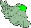
 Iran locator29.png 1,024 × 849; 48 KB
-
 IranRazaviKhorasan.png 879 × 813; 25 KB
-
 Khorasan 2020.svg 676 × 1,082; 153 KB
-
 Khorasan counties 1966.svg 247 × 365; 67 KB
-
 Khorasan Province 1956.svg 688 × 1,118; 42 KB
-
 Khorasan Razavi administrative map.png 1,157 × 1,083; 64 KB
-
 Khorasan Razavi administrative map.svg 750 × 693; 429 KB
-
 Khurasan division.svg 400 × 600; 18 KB
-
 Locator map Iran Razavi Khorasan Province.png 672 × 600; 131 KB
-
 Mapofkhorasan1775.png 1,952 × 2,144; 258 KB
-
 MashhadLocation.gif 200 × 185; 4 KB
-
 Naim Abad-Firozi.jpg 7,650 × 9,900; 9.25 MB
-
 Naim Abad.jpg 7,650 × 9,900; 15.28 MB
-
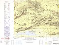
 NI 40-2 Baghestan, Iran.jpg 5,000 × 3,777; 4.63 MB
-
 NI 40-3 Kashmar, Iran.jpg 5,000 × 3,777; 3.83 MB
-
 NI 40-4 Torbat-e Heydariyeh, Iran.jpg 5,000 × 3,791; 4.22 MB
-
 NI 40-7 Ferdows, Iran.jpg 5,000 × 3,837; 3.42 MB
-
 NI 40-8 Juymand, Iran.jpg 5,000 × 3,808; 3.69 MB
-
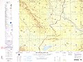
 NI 41-1 Torbat-e Jam, Iran; Afghanistan; USSR.jpg 5,000 × 3,756; 3.71 MB
-
 NI 41-5 Taybad, Iran; Afghanistan.jpg 5,000 × 3,742; 2.67 MB
-
 NJ 40-16 Mashhad, Iran.jpg 5,000 × 3,777; 3.8 MB
-
 NJ 40-16 Mashhad.jpg 4,267 × 3,247; 3.16 MB
-
 NJ 41-13 Sarakhs, Iran; Soviet Union.jpg 5,000 × 3,799; 3.31 MB
-
 Razavi Khorasan Constituencies.png 2,000 × 1,859; 109 KB
-
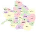
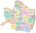
 Razavi Khorasan fa.svg 850 × 780; 462 KB
-
 Razavi Khorasan in Iran.svg 512 × 457; 333 KB
-
 Razavi Khorasan province 2017 - grey.svg 564 × 467; 163 KB
-
 Razavi Khorasan province 2017.svg 480 × 425; 158 KB
-
 Razavi Khorasan province 2020.svg 590 × 551; 91 KB
-
 Razavi Khorasan province 2021 (Colorless-Untitled).svg 667 × 613; 197 KB
-
 Razavi Khorasan province 2023.png 1,844 × 1,722; 1.92 MB
-
 Razavi Khorasan province 2024 (Colored-Titled).svg 641 × 590; 133 KB
-
 Razavi Khorasan province 2024 (Colorless-Untitled).svg 641 × 590; 127 KB
-
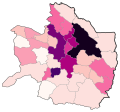 Razavi Khorasan province density 2020.svg 590 × 551; 75 KB
-
 Razavi Khorasan.svg 850 × 780; 559 KB
-
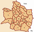 RazaviHorsanOkruzi.PNG 800 × 750; 164 KB
-
 Rosta-e Naimabad.jpg 7,650 × 9,900; 5.74 MB
-
 Sabzavar Map Txu-pclmaps-oclc-6631562-NJ40-15.jpg 4,269 × 3,228; 2.99 MB


.svg)

.svg)
.svg)


