Category:Maps of northern Iran
Jump to navigation
Jump to search
Subcategories
This category has the following 10 subcategories, out of 10 total.
Media in category "Maps of northern Iran"
The following 10 files are in this category, out of 10 total.
-
DistributionOfAzerbaijanisMap.png 1,594 × 1,370; 341 KB
-
IranAlborz-SVG.svg 1,200 × 1,071; 472 KB
-
IranArdabil-SVG.svg 1,200 × 1,071; 472 KB
-
IranEastAzerbaijan-SVG.svg 1,200 × 1,071; 472 KB
-
IranQazvin.svg 1,200 × 1,071; 470 KB
-
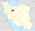
IranQom.svg 1,200 × 1,071; 470 KB
-
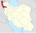
IranWestAzerbaijan-SVG.svg 1,200 × 1,071; 472 KB
-
IranZanjan-SVG.svg 1,200 × 1,071; 470 KB
-
Kürdüstan İyaləti.jpg 1,009 × 827; 96 KB
-
Provinces of Iran with significant Turkic-speaking population.png 879 × 813; 44 KB


