Category:Maps of the Near East
Jump to navigation
Jump to search
Maps of the Near East — in Western Asia.
Subcategories
This category has the following 9 subcategories, out of 9 total.
Media in category "Maps of the Near East"
The following 22 files are in this category, out of 22 total.
-
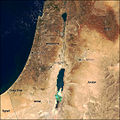 Modis near east.jpg 540 × 540; 80 KB
-
 2000px-Distribution Haplogroup J2 Y-DNA.jpg 1,989 × 1,091; 123 KB
-
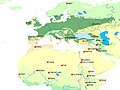
 Blízký východ očima studentů.jpg 3,507 × 2,480; 502 KB
-
 Eastern Mediterranean EEZ conflicts-fr.svg 488 × 327; 110 KB
-
 Eastern Mediterranean EEZ conflicts.svg 488 × 327; 110 KB
-
 EuropeMap1328-ar.png 1,075 × 1,168; 917 KB
-
 Mediterania Timur.png 3,421 × 3,890; 561 KB
-
 Circum-mediterannean sccs cultures.jpg 751 × 563; 231 KB
-
 Mediterranean Basin and Near East before 1000 AD locator map.svg 3,000 × 1,856; 435 KB
-

-
 Mediterranean Basin and Near East before 1000 AD topographic map.jpg 3,000 × 1,856; 2.23 MB
-
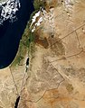
 MiddleEast A2003031 0820 250m without lines.jpg 2,200 × 2,800; 1.7 MB
-
 MiddleEast.A2003031.0820.250m (cropped-01).jpg 826 × 1,754; 662 KB
-
 MiddleEast.A2003031.0820.250m (cropped-02).jpg 549 × 635; 191 KB
-
 MiddleEast.A2003031.0820.250m.jpg 2,200 × 2,800; 1.19 MB
-
 Near East (orthographic projection).svg 553 × 553; 407 KB
-
 Near East non political.png 1,490 × 842; 1.85 MB
-
 Physical map of Levant and Iraq.svg 1,147 × 515; 5.28 MB
-
 Syria under the Seleucids 92 BC.jpg 1,095 × 964; 301 KB
-
 The Eastern world.svg 7,030 × 3,542; 3.38 MB
-
 Three Easts.svg 2,754 × 1,398; 1.13 MB
-
 Сукман Якути (2).svg 2,446 × 1,392; 2.57 MB


.jpg)


.jpg)
.jpg)

.svg)


.svg)