Category:Maps of the history of the Levant
Jump to navigation
Jump to search
| Category Maps of the history of the Levant on sister projects: | |||||||||
|---|---|---|---|---|---|---|---|---|---|
This category is for maps about the Levant, and the History of the Levant.
Subcategories
This category has the following 24 subcategories, out of 24 total.
A
C
M
- Maps of Idumaea (2 F)
- Maps of the First Crusade (35 F)
- Maps of the Fourth Crusade (31 F)
- Maps of Muhammad Ali dynasty (24 F)
O
Pages in category "Maps of the history of the Levant"
This category contains only the following page.
Media in category "Maps of the history of the Levant"
The following 95 files are in this category, out of 95 total.
-
C. 1100 Eastern Roman Empire.jpg 1,859 × 1,395; 2.73 MB
-
Campaign of the Battle of Ain Jalut 1260.svg 432 × 572; 146 KB
-
Mongol raids in Syria and Palestine 1260.svg 657 × 901; 316 KB
-
3ciutats dels estats croats.png 1,395 × 2,383; 689 KB
-
1865 Spruner Map of the Holy Land - 4th-5th century Levant crop.jpg 610 × 906; 156 KB
-
71 of 'Ten Centuries of European Progress. (With maps.)' (11209230114).jpg 2,167 × 1,328; 646 KB
-
A chart of the Levant - Seller John The English Pilot - 1771.jpg 1,500 × 1,189; 844 KB
-
Antique jew diaspora map fr.svg 855 × 549; 496 KB
-
Antique jew diaspora map with Acts of the Apostles mention highlight.svg 855 × 549; 500 KB
-
Arab Caliphate.jpg 888 × 674; 220 KB
-
Arab Caliphate.svg 350 × 334; 1.04 MB
-
BeglerbeicSHAM.jpg 599 × 575; 50 KB
-
C+B-Judah-Map.JPG 1,402 × 966; 520 KB
-
Campagna della battaglia di Ain Jalut-1260.svg 432 × 572; 195 KB
-
Campaign Ain Galut-ar.png 432 × 573; 67 KB
-
Campaign of the Battle of Ain Jalut 1260 hu.svg 432 × 572; 178 KB
-
Campaign of the Battle of Ain Jalut 1260-ms.svg 432 × 572; 99 KB
-
Campaign of the Battle of Ain Jalut 1260-ru.svg 432 × 572; 60 KB
-
Campanha da Batalha de Ain Jalut 1260-es.svg 432 × 572; 207 KB
-
Campanha da Batalha de Ain Jalut 1260.svg 432 × 572; 68 KB
-
CiliciaPrincipadoDeAntioquíaYCondadoDeTrípoli.svg 955 × 1,315; 180 KB
-
Cilicië, Cyprus, Syrië en de Fenicische kust in de oudheid.png 865 × 856; 978 KB
-
Ciutats dels estatas llatins2.png 995 × 2,283; 627 KB
-
Ciutats dels estats llatins2.png 995 × 2,383; 639 KB
-
Colonie italiane.jpg 1,556 × 2,008; 401 KB
-
Crusade states in levant.PNG 291 × 504; 14 KB
-
Ein-jalut-fa.png 432 × 572; 75 KB
-
Kingdoms around Israel 830 map af.svg 720 × 859; 70 KB
-
Kingdoms around Israel 830 map mk.svg 720 × 859; 177 KB
-
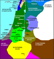
Kingdoms around Israel 830 map-de.png 1,004 × 1,198; 318 KB
-
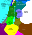
Kingdoms around Israel 830 map-el.svg 720 × 859; 509 KB
-
Kingdoms around Israel 830 map-eu.svg 720 × 859; 76 KB
-
Kingdoms around Israel 830 map-nl.svg 720 × 859; 479 KB
-
Kingdoms around Israel 830 map.svg 720 × 859; 122 KB
-
Kingdoms of the Levant Map 830.png 1,955 × 2,332; 438 KB
-
Kingdoms of the Levant Map 830.xcf 1,955 × 2,332; 941 KB
-
LA SYRIE INTÉGRALE 1915-fr.svg 640 × 445; 50 KB
-
Levant 830 nl 3.PNG 771 × 839; 153 KB
-
Levant 830-rus.svg 545 × 591; 68 KB
-
Levant hu.svg 545 × 591; 67 KB
-
Levant Neolithicum.JPG 3,476 × 1,865; 1,000 KB
-
Levante 830-es.svg 646 × 753; 262 KB
-
Levante 830.svg 545 × 591; 80 KB
-
Levanti riigid.jpg 800 × 954; 280 KB
-
Mamluk Sultanate.JPG 1,357 × 628; 40 KB
-
Map Crusader states 1102-es.svg 591 × 690; 359 KB
-
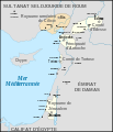
Map Crusader states 1102-fr.svg 591 × 690; 118 KB
-
Map Crusader states 1102-hu.svg 591 × 690; 73 KB
-
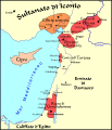
Map Crusader states 1102-it.svg 591 × 690; 716 KB
-
Map Crusader states 1102-pt.svg 591 × 690; 42 KB
-
Map Crusader states 1135-de2.svg 690 × 738; 563 KB
-
Map Crusader states 1135-pl.png 1,631 × 2,217; 632 KB
-
Map Crusader states 1148-fa.svg 978 × 1,330; 385 KB
-
Map Crusader states 1165-en.svg 955 × 1,315; 362 KB
-
Map Crusader states 1165-es.svg 955 × 1,315; 662 KB
-
Map Crusader states 1165-fa.svg 955 × 1,315; 308 KB
-
Map Crusader states 1165-it.svg 955 × 1,315; 129 KB
-
Map Crusader states 1165-pt.svg 955 × 1,315; 117 KB
-
Map Crusader states 1197-en.svg 507 × 690; 76 KB
-
Map Crusader states 1197-es.svg 507 × 690; 114 KB
-
Map Crusader states 1197-fr.svg 507 × 690; 596 KB
-
Map Crusader states 1197-it.svg 507 × 690; 77 KB
-
Map Crusader states 1197-ka.png 502 × 683; 104 KB
-
Map Crusader states 1240-de.svg 507 × 690; 162 KB
-
Map Crusader states 1240-eng.png 600 × 823; 110 KB
-
Map Crusader states 1240-es.svg 507 × 690; 385 KB
-
Map Crusader states 1240-fa.png 600 × 823; 117 KB
-
Map Crusader states 1240-fr.svg 507 × 690; 636 KB
-
Map Crusader states 1240-it.svg 507 × 690; 699 KB
-
Map Crusader states 1240-pt.svg 507 × 690; 38 KB
-
Mohammad adil-invasion of syria.PNG 505 × 416; 12 KB
-
Mongol raids in Syria and Palestine 1260-ar.svg 657 × 901; 318 KB
-
Mongol raids in Syria and Palestine 1260-es.svg 657 × 901; 383 KB
-
Mongol raids in Syria and Palestine 1260-he.svg 657 × 901; 272 KB
-
Mongol raids in Syria and Palestine 1260-hu.svg 657 × 901; 210 KB
-
Mongol raids in Syria and Palestine 1260-pt.svg 657 × 901; 173 KB
-
Mongol raids into Syria and Palestine ca 1300 Ar.jpg 438 × 600; 210 KB
-
Mongol raids into Syria and Palestine ca 1300 Ar.png 826 × 1,125; 712 KB
-
Mongol raids into Syria and Palestine ca 1300 ru.svg 657 × 901; 84 KB
-
Mongol raids into Syria and Palestine ca 1300-es.svg 657 × 901; 167 KB
-
Mongol raids into Syria and Palestine ca 1300-he.svg 657 × 901; 265 KB
-
Mongol raids into Syria and Palestine ca 1300-hu.svg 657 × 901; 164 KB
-
Mongol raids into Syria and Palestine ca 1300-pt.svg 657 × 901; 167 KB
-
Mongol raids into Syria and Palestine ca 1300.svg 657 × 901; 241 KB
-
Raids mongoli in Siria e Palestina-1260.it.svg 657 × 901; 434 KB
-
Raids mongoli in Siria e Palestina-1300 ca.it.svg 657 × 901; 397 KB
-
Regions of Bilad al-Sham by al-Muqaddasi.png 927 × 968; 1.37 MB
-
Royaumes autour d'Israel en 830.svg 720 × 859; 99 KB
-
SASH D016 Topographical map of syria.jpg 2,394 × 3,896; 3.16 MB
-
D595 - N° 312. Royaumes chrétiens en Orient. -liv3-ch6.png 1,442 × 1,956; 200 KB
-
Thedecapolis.png 513 × 752; 112 KB
-
Umayyad-Empire.png 680 × 451; 24 KB
-
الدولتان الطولونية والإخشيدية.jpg 641 × 933; 216 KB


